MyTopo
Ridgway Montana US Topo Map
Couldn't load pickup availability
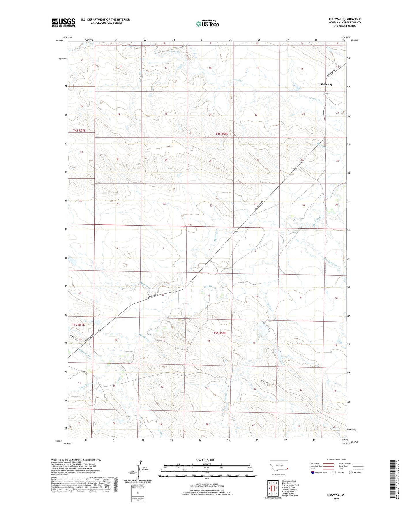
2024 topographic map quadrangle Ridgway in the state of Montana. Scale: 1:24000. Based on the newly updated USGS 7.5' US Topo map series, this map is in the following counties: Carter. The map contains contour data, water features, and other items you are used to seeing on USGS maps, but also has updated roads and other features. This is the next generation of topographic maps. Printed on high-quality waterproof paper with UV fade-resistant inks.
Quads adjacent to this one:
West: Whitetail Creek
Northwest: Dutchman Creek
North: Ikey Creek
Northeast: School Section Creek
East: Prairie Dog Creek
Southeast: Finger Buttes West
South: Potato Buttes
Southwest: Tip Top Butte
This map covers the same area as the classic USGS quad with code o45104d5.
Contains the following named places: 05S58E08DBCC01 Well, 05S58E17BAAB01 Well, Blackford Number 3 Dam, Blackford Number 5 Dam, Ewalt School, Hawks Home Post Office, Hope Baptist Church, L O Creek, Muskrat Creek, R Owen Number 1 Dam, Ridgeway, Ridgway Post Office, Ridgway School, South Fork Corral Creek, Trail Creek, Whitetail Creek