MyTopo
Ikey Creek Montana US Topo Map
Couldn't load pickup availability
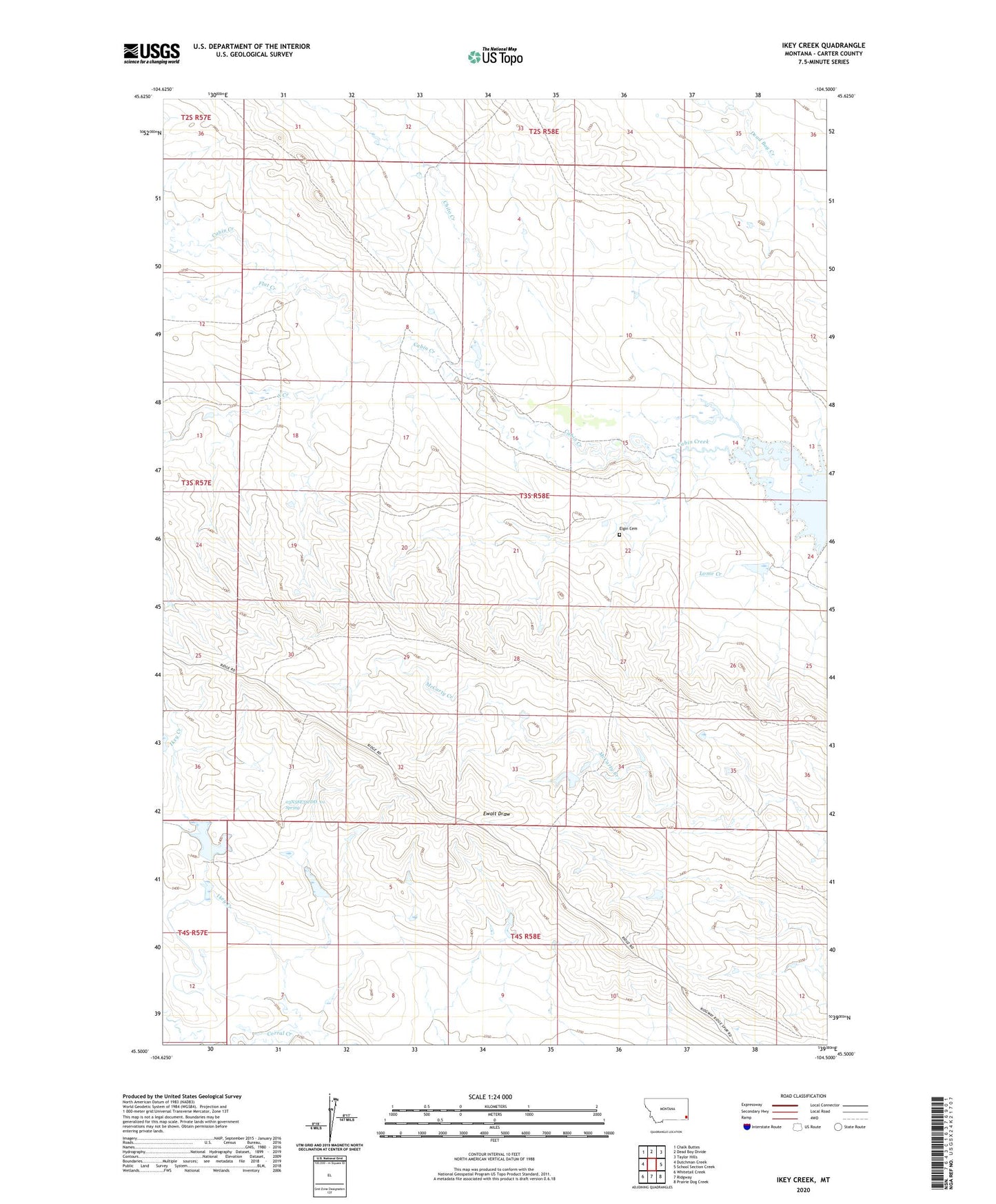
2024 topographic map quadrangle Ikey Creek in the state of Montana. Scale: 1:24000. Based on the newly updated USGS 7.5' US Topo map series, this map is in the following counties: Carter. The map contains contour data, water features, and other items you are used to seeing on USGS maps, but also has updated roads and other features. This is the next generation of topographic maps. Printed on high-quality waterproof paper with UV fade-resistant inks.
Quads adjacent to this one:
West: Dutchman Creek
Northwest: Chalk Buttes
North: Dead Boy Divide
Northeast: Taylor Hills
East: School Section Creek
Southeast: Prairie Dog Creek
South: Ridgway
Southwest: Whitetail Creek
This map covers the same area as the classic USGS quad with code o45104e5.
Contains the following named places: 03N58E05AAA_01 Well, 03N58E07DAA_01 Well, 03N58E31CDD_01 Spring, 03S58E02DC__01 Well, Carter County, Chito Creek, Ding Dong Dam, Elgin Cemetery, Flat Creek, Ikey Creek, Johnston and Son Ranch Number 4 Dam, Lome Creek, Major Number 1 Dam, One D-4 Ranch Dam, Penny Dam, South Creek, Tauck Number 3 Dam