MyTopo
Saddle Horse Butte Montana US Topo Map
Couldn't load pickup availability
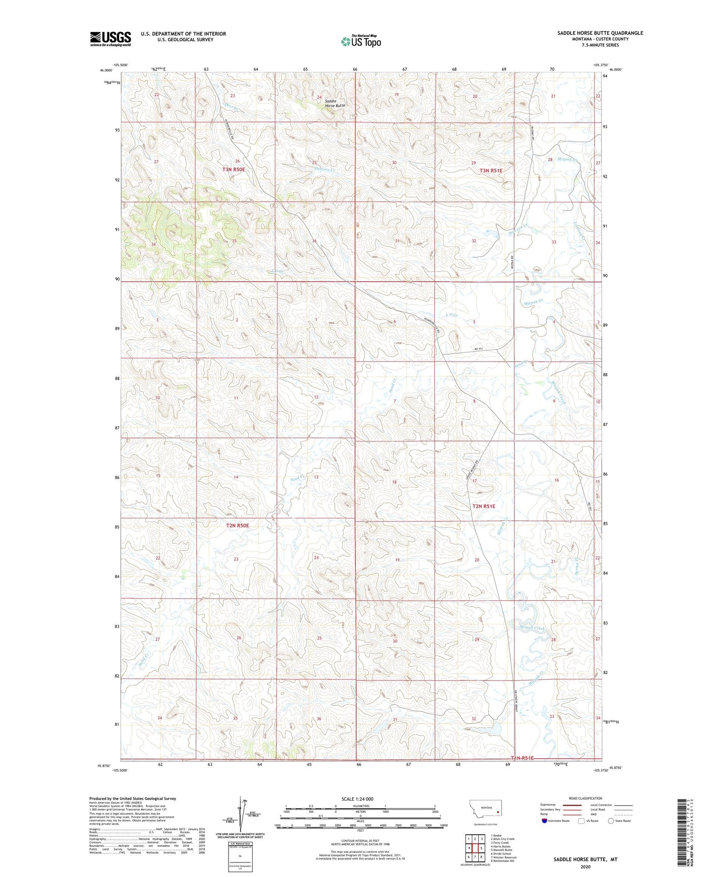
2020 topographic map quadrangle Saddle Horse Butte in the state of Montana. Scale: 1:24000. Based on the newly updated USGS 7.5' US Topo map series, this map is in the following counties: Custer. The map contains contour data, water features, and other items you are used to seeing on USGS maps, but also has updated roads and other features. This is the next generation of topographic maps. Printed on high-quality waterproof paper with UV fade-resistant inks.
Quads adjacent to this one:
West: Harris Buttes
Northwest: Beebe
North: Miles City Creek
Northeast: Forty Creek
East: Maxwell Butte
Southeast: Rattlesnake Hill
South: Witcher Reservoir
Southwest: Divide School
Contains the following named places: 02N51E04CCCC01 Well, 02N51E18DDBA01 Well, 03N51E32CCCD01 Well, 03S51E18DABB01 Well, Dama Post Office, Dawson Creek, Elmhurst Creek, Fox Dam, Fox Number 1 Dam, Holts, L O Creek, Lindsey Creek, M Hardy Number 3 Dam, Saddle Horse Butte, Sand Creek, Spring Creek