MyTopo
Maxwell Butte Montana US Topo Map
Couldn't load pickup availability
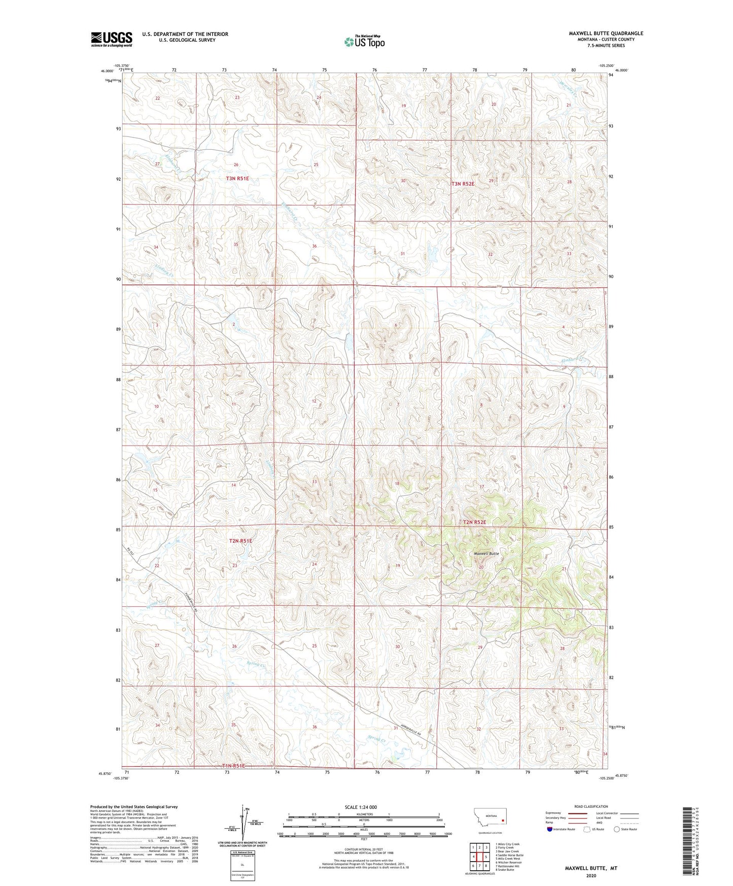
2024 topographic map quadrangle Maxwell Butte in the state of Montana. Scale: 1:24000. Based on the newly updated USGS 7.5' US Topo map series, this map is in the following counties: Custer. The map contains contour data, water features, and other items you are used to seeing on USGS maps, but also has updated roads and other features. This is the next generation of topographic maps. Printed on high-quality waterproof paper with UV fade-resistant inks.
Quads adjacent to this one:
West: Saddle Horse Butte
Northwest: Miles City Creek
North: Forty Creek
Northeast: Bear Jaw Creek
East: Mills Creek West
Southeast: Snake Butte
South: Rattlesnake Hill
Southwest: Witcher Reservoir
This map covers the same area as the classic USGS quad with code o45105h3.
Contains the following named places: 02N51E11AACD01 Well, 02N51E36DC__01 Well, 02N52E31AAAD01 Well, 03N51E36BCAD01 Well, 03N52E32CBBD01 Well, 14N50E34AAAB01 Well, Fox Number 3 Dam, Fox Number 4 Dam, Fox Number 5 Dam, L and L Dam, L Krutzfeldt Number 1 Dam, Maxwell Butte, Rafferty Number 1 Dam, Rafferty Number 2 Dam, Rafferty Number 3 Dam, Rafferty Number 4 Dam, Robinson Number 1 Dam