MyTopo
Witcher Reservoir Montana US Topo Map
Couldn't load pickup availability
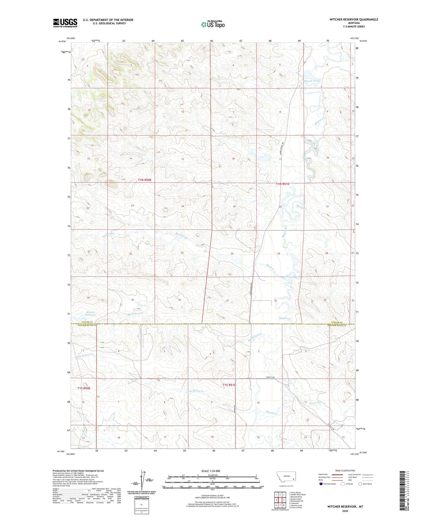
2024 topographic map quadrangle Witcher Reservoir in the state of Montana. Scale: 1:24000. Based on the newly updated USGS 7.5' US Topo map series, this map is in the following counties: Custer, Powder River. The map contains contour data, water features, and other items you are used to seeing on USGS maps, but also has updated roads and other features. This is the next generation of topographic maps. Printed on high-quality waterproof paper with UV fade-resistant inks.
Quads adjacent to this one:
West: Divide School
Northwest: Harris Buttes
North: Saddle Horse Butte
Northeast: Maxwell Butte
East: Rattlesnake Hill
Southeast: Cross S School
South: Johnnie Creek
Southwest: Coalwood
This map covers the same area as the classic USGS quad with code o45105g4.
Contains the following named places: 01N50E22DADB01 Well, 02N51E05DAAB01 Well, Big Bobcat Creek, Corral Creek, Cross S Creek, Horse Creek, Little Bobcat Creek, Ness Number 1 Dam, Rafferty Number 5 Dam, Road Creek, Russiff Number 2 Dam, W Krutzfeldt Number 1 Dam, W Krutzfeldt Number 2 Dam, W Krutzfeldt Number 3 Dam, W Krutzfeldt Number 4 Dam, Witcher Dam, Witcher Reservoir