MyTopo
Saint Johns Montana US Topo Map
Couldn't load pickup availability
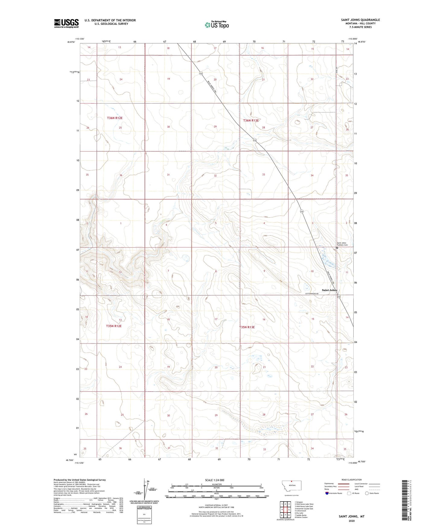
2024 topographic map quadrangle Saint Johns in the state of Montana. Scale: 1:24000. Based on the newly updated USGS 7.5' US Topo map series, this map is in the following counties: Hill. The map contains contour data, water features, and other items you are used to seeing on USGS maps, but also has updated roads and other features. This is the next generation of topographic maps. Printed on high-quality waterproof paper with UV fade-resistant inks.
Quads adjacent to this one:
West: Ninemile Coulee East
Northwest: Simpson
North: Wild Horse Lake West
Northeast: Wild Horse Lake East
East: Cottonwood
Southeast: Kiehns Coulee
South: Saddle Butte
Southwest: Dry Lake
This map covers the same area as the classic USGS quad with code o48110g1.
Contains the following named places: 35N13E21CCBD01 Well, Miller Post Office, Miller School, Saint John Church, Saint Johns, Saint Johns Catholic Cemetery, Sigurd Dam