
MyTopo
Saltese Montana US Topo Map
Couldn't load pickup availability
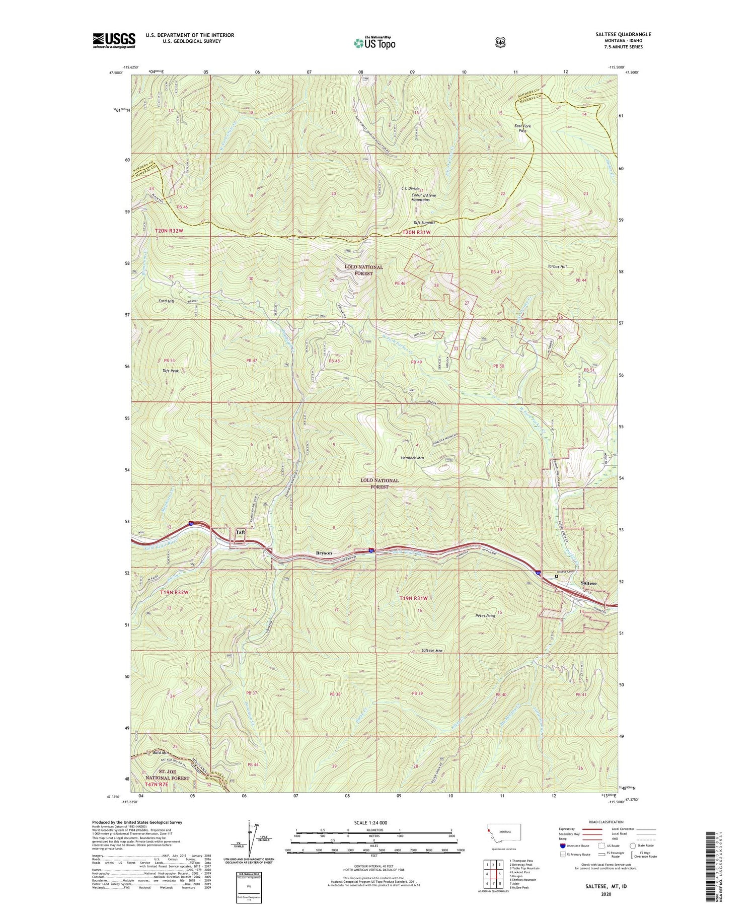
2020 topographic map quadrangle Saltese in the states of Montana, Idaho. Scale: 1:24000. Based on the newly updated USGS 7.5' US Topo map series, this map is in the following counties: Mineral, Sanders, Shoshone. The map contains contour data, water features, and other items you are used to seeing on USGS maps, but also has updated roads and other features. This is the next generation of topographic maps. Printed on high-quality waterproof paper with UV fade-resistant inks.
Quads adjacent to this one:
West: Lookout Pass
Northwest: Thompson Pass
North: Driveway Peak
Northeast: Table Top Mountain
East: Haugan
Southeast: McGee Peak
South: Adair
Southwest: Shefoot Mountain
Contains the following named places: Bald Mountain, Big Sunday Creek, Boston Colby Mine, Bryan Mine, Bryson, Burke Creek, Dominion Creek, East Fork Pass, Ford Hill, Hemlock Mine, Hemlock Mountain, Inland Mine, Last Chance Creek, Last Chance Mine, Last Chance Mines, Little Sunday Creek, Meadow Mountain Mine, Meadow Mountain Mines, Mephisto Creek, Packer Creek, Petes Point, Polleys Spur, Rainy Creek, Randolph Creek, Saltese, Saltese Cemetery, Saltese Census Designated Place, Saltese Mountain, Saltese Post Office, Saltese School, Silver Cable Mine, Silver Creek, Synidicate Prospect Mine, Taft, Taft Peak, Taft Post Office, Taft School, Taft Summit, Tarbox Hill, West Fork Packer Creek, ZIP Code: 59867


