MyTopo
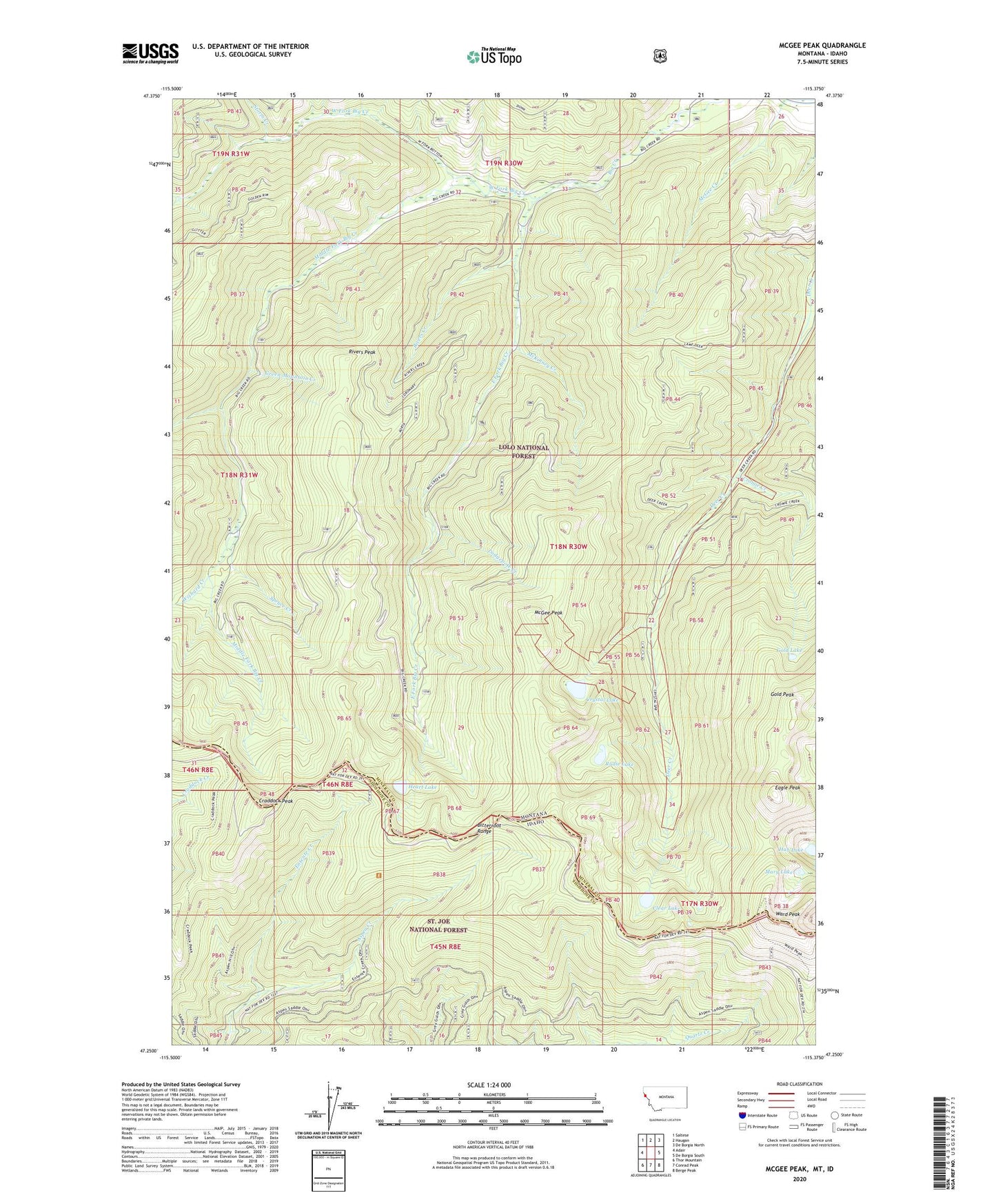
McGee Peak Montana US Topo Map
Couldn't load pickup availability
Also explore the McGee Peak Forest Service Topo of this same quad for updated USFS data
2024 topographic map quadrangle McGee Peak in the states of Montana, Idaho. Scale: 1:24000. Based on the newly updated USGS 7.5' US Topo map series, this map is in the following counties: Mineral, Shoshone. The map contains contour data, water features, and other items you are used to seeing on USGS maps, but also has updated roads and other features. This is the next generation of topographic maps. Printed on high-quality waterproof paper with UV fade-resistant inks.
Quads adjacent to this one:
West: Adair
Northwest: Saltese
North: Haugan
Northeast: De Borgia North
East: De Borgia South
Southeast: Berge Peak
South: Conrad Peak
Southwest: Thor Mountain
This map covers the same area as the classic USGS quad with code o47115c4.
Contains the following named places: Aspen Creek, Big Creek Mine, Clear Lake, Craddock Peak, Cromie Creek, Crystal Lake, Eagle Peak, East Fork Big Creek, Gilt Edge Creek, Gold Chrome Mine, Gold Lake, Gold Peak, Green Mountain Creek, Heart Lake, Hub Lake, Lodgepole Creek, Mary Lake, McGee Peak, McKinney Creek, Middle Fork Big Creek, Minnick Mine, Rivers Creek, Rivers Peak, Rudie Lake, Spruce Creek, Storm Creek, Up Up Creek, Ward Cabin, Ward Peak, West Fork Big Creek, West Fork Middle Fork Big Creek, Wishard Creek, ZIP Code: 59842