MyTopo
Wood Lake Montana US Topo Map
Couldn't load pickup availability
Also explore the Wood Lake Forest Service Topo of this same quad for updated USFS data
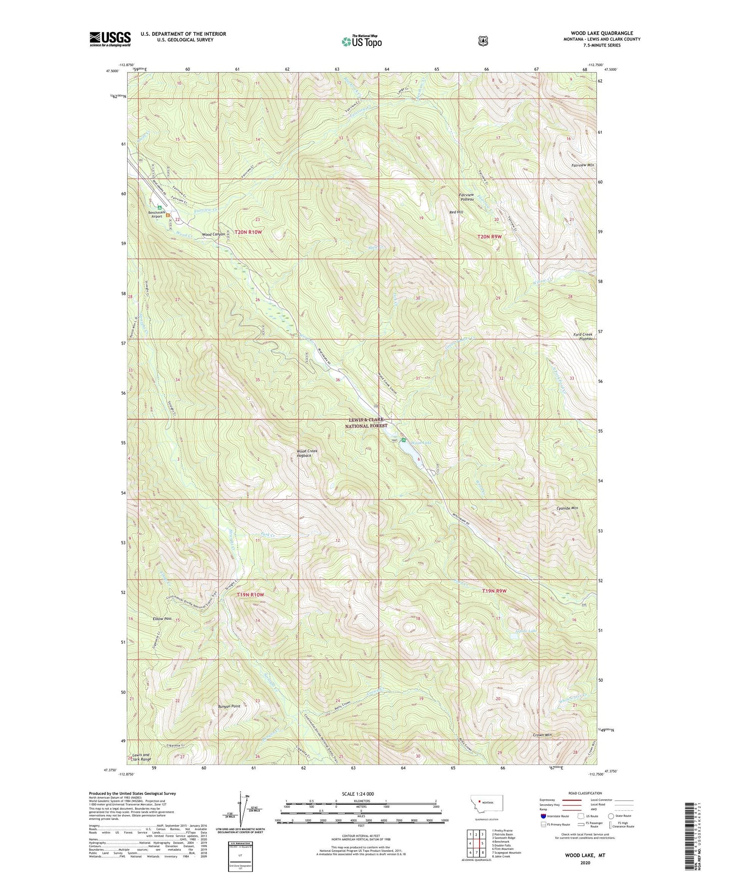
2024 topographic map quadrangle Wood Lake in the state of Montana. Scale: 1:24000. Based on the newly updated USGS 7.5' US Topo map series, this map is in the following counties: Lewis and Clark. The map contains contour data, water features, and other items you are used to seeing on USGS maps, but also has updated roads and other features. This is the next generation of topographic maps. Printed on high-quality waterproof paper with UV fade-resistant inks.
Quads adjacent to this one:
West: Benchmark
Northwest: Pretty Prairie
North: Patricks Basin
Northeast: Sawtooth Ridge
East: Double Falls
Southeast: Jakie Creek
South: Scapegoat Mountain
Southwest: Flint Mountain
This map covers the same area as the classic USGS quad with code o47112d7.
Contains the following named places: Alpine Lake, Benchmark Wilderness Ranch, Blackrock Creek, Bunyan Creek, Bunyan Point, Cigarette Creek, Crown Creek, Crown Mountain, Cyanide Mountain, Elbow Creek, Elbow Pass, Elbow Pass Trail, Fairview Creek, Fairview Mountain, Fairview Plateau, Fairview Trail, Fly in Campground, Ford Creek Plateau, Green Timber Creek, Lick Creek, Mule Creek, Park Creek, Patrol Mountain Lookout Trail, Petty Crown Creek Trail, Red Hill, Renshaw Creek, Wood Canyon, Wood Creek Hogback, Wood Lake, Wood Lake Campground, Wood Lake Dam