MyTopo
Shade Creek Montana US Topo Map
Couldn't load pickup availability
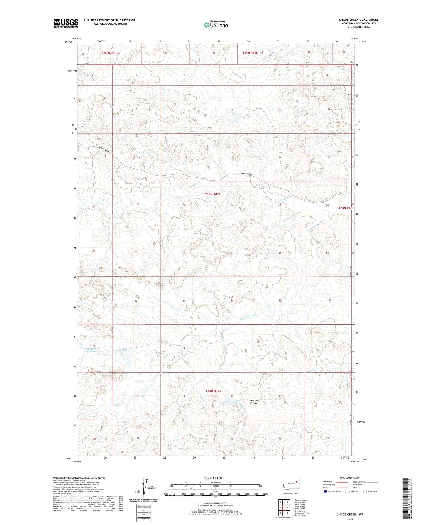
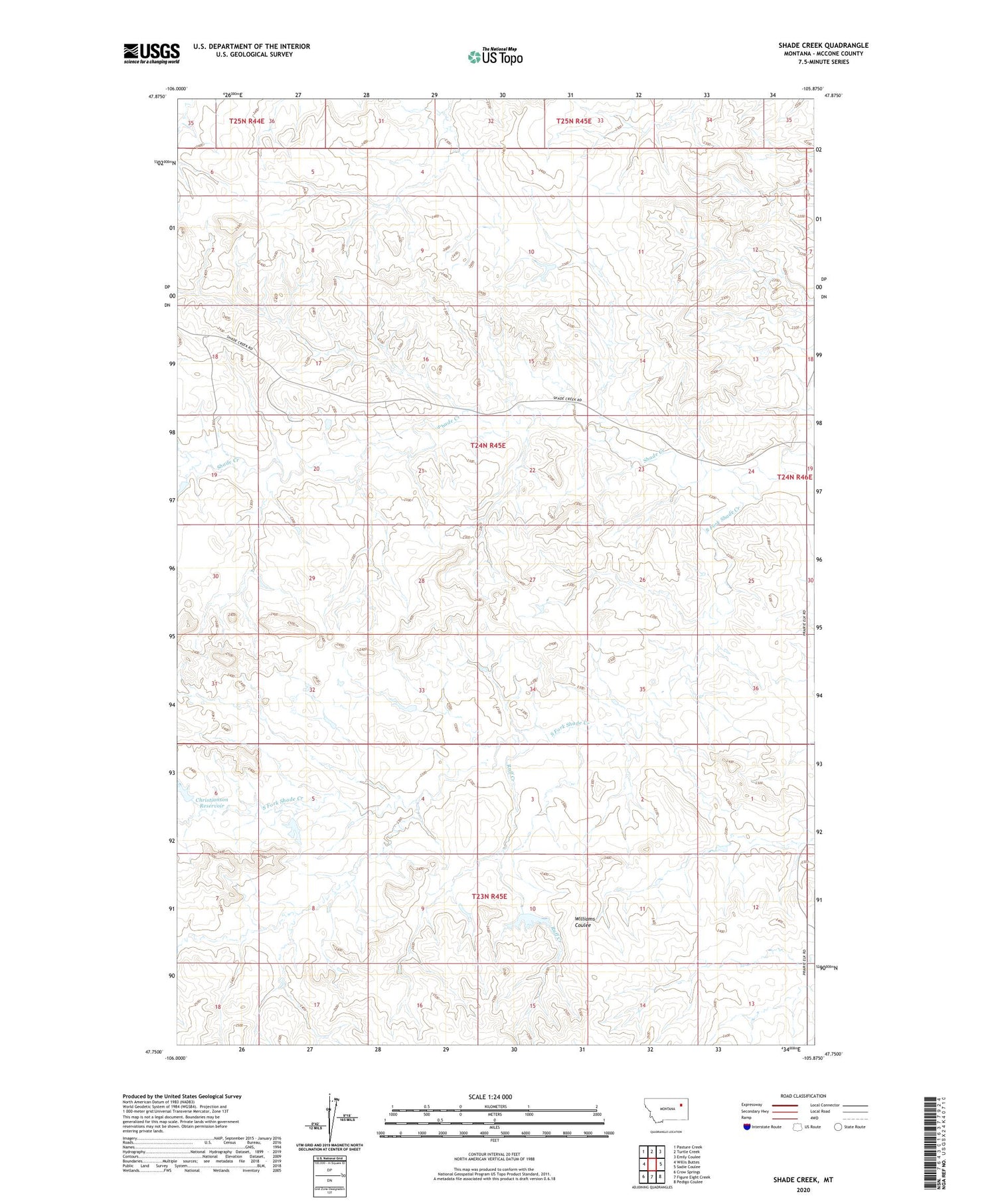
2020 topographic map quadrangle Shade Creek in the state of Montana. Scale: 1:24000. Based on the newly updated USGS 7.5' US Topo map series, this map is in the following counties: McCone. The map contains contour data, water features, and other items you are used to seeing on USGS maps, but also has updated roads and other features. This is the next generation of topographic maps. Printed on high-quality waterproof paper with UV fade-resistant inks.
Quads adjacent to this one:
West: Willis Buttes
Northwest: Pasture Creek
North: Turtle Creek
Northeast: Emily Coulee
East: Sadie Coulee
Southeast: Pedigo Coulee
South: Figure Eight Creek
Southwest: Crow Springs
Contains the following named places: 23N45E12DCC_01 Well, 24N45E01BB__01 Well, 24N45E08ADAD01 Well, 24N45E21AABB01 Well, 24N45E25CACC01 Well, 25N45E33DC__01 Well, Christianson Dam, Christianson Reservoir, Ruff Creek, Ruff Dam, South Fork Shade Creek, Taylor Shade Dam, Torn Apart Dam