MyTopo
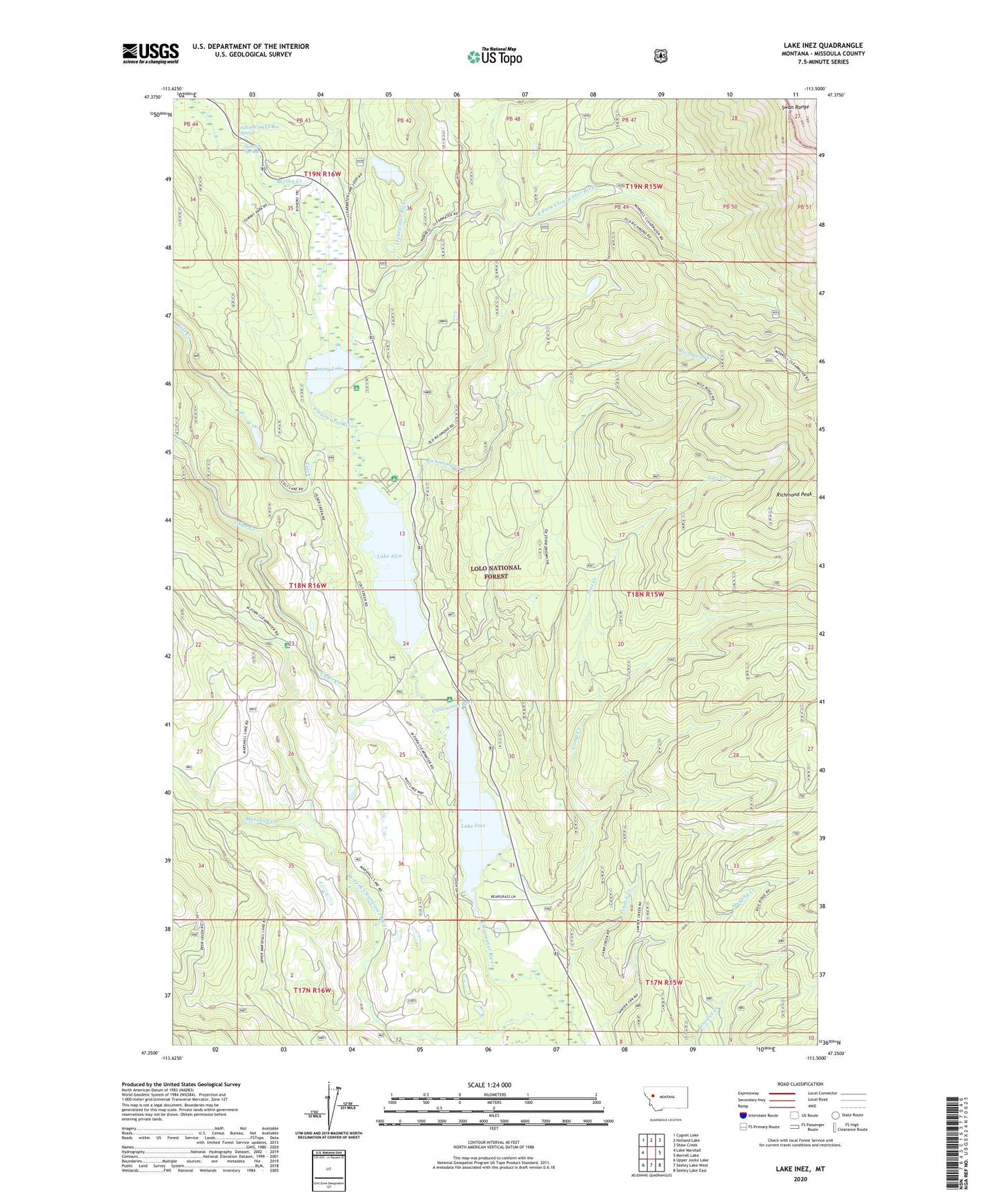
Lake Inez Montana US Topo Map
Couldn't load pickup availability
Also explore the Lake Inez Forest Service Topo of this same quad for updated USFS data
2024 topographic map quadrangle Lake Inez in the state of Montana. Scale: 1:24000. Based on the newly updated USGS 7.5' US Topo map series, this map is in the following counties: Missoula. The map contains contour data, water features, and other items you are used to seeing on USGS maps, but also has updated roads and other features. This is the next generation of topographic maps. Printed on high-quality waterproof paper with UV fade-resistant inks.
Quads adjacent to this one:
West: Lake Marshall
Northwest: Cygnet Lake
North: Holland Lake
Northeast: Shaw Creek
East: Morrell Lake
Southeast: Seeley Lake East
South: Seeley Lake West
Southwest: Upper Jocko Lake
This map covers the same area as the classic USGS quad with code o47113c5.
Contains the following named places: 18N15W31CBBC01 Well, 19N16W26CCCB01 Spring, 19N16W35ACBD01 Well, Bertha Creek, Camp Creek, Colt Creek, East Fork Clearwater River, Findell Creek, Inez Creek, Lake Alva, Lake Alva Campground, Lake Inez, Lake Inez Campground, Marshall Creek, Murphy Creek, Rainy Lake, Rainy Lake Campground, Richmond Creek, Summit Springs, Uhler Creek, West Fork Clearwater River