MyTopo
Morrell Lake Montana US Topo Map
Couldn't load pickup availability
Also explore the Morrell Lake Forest Service Topo of this same quad for updated USFS data
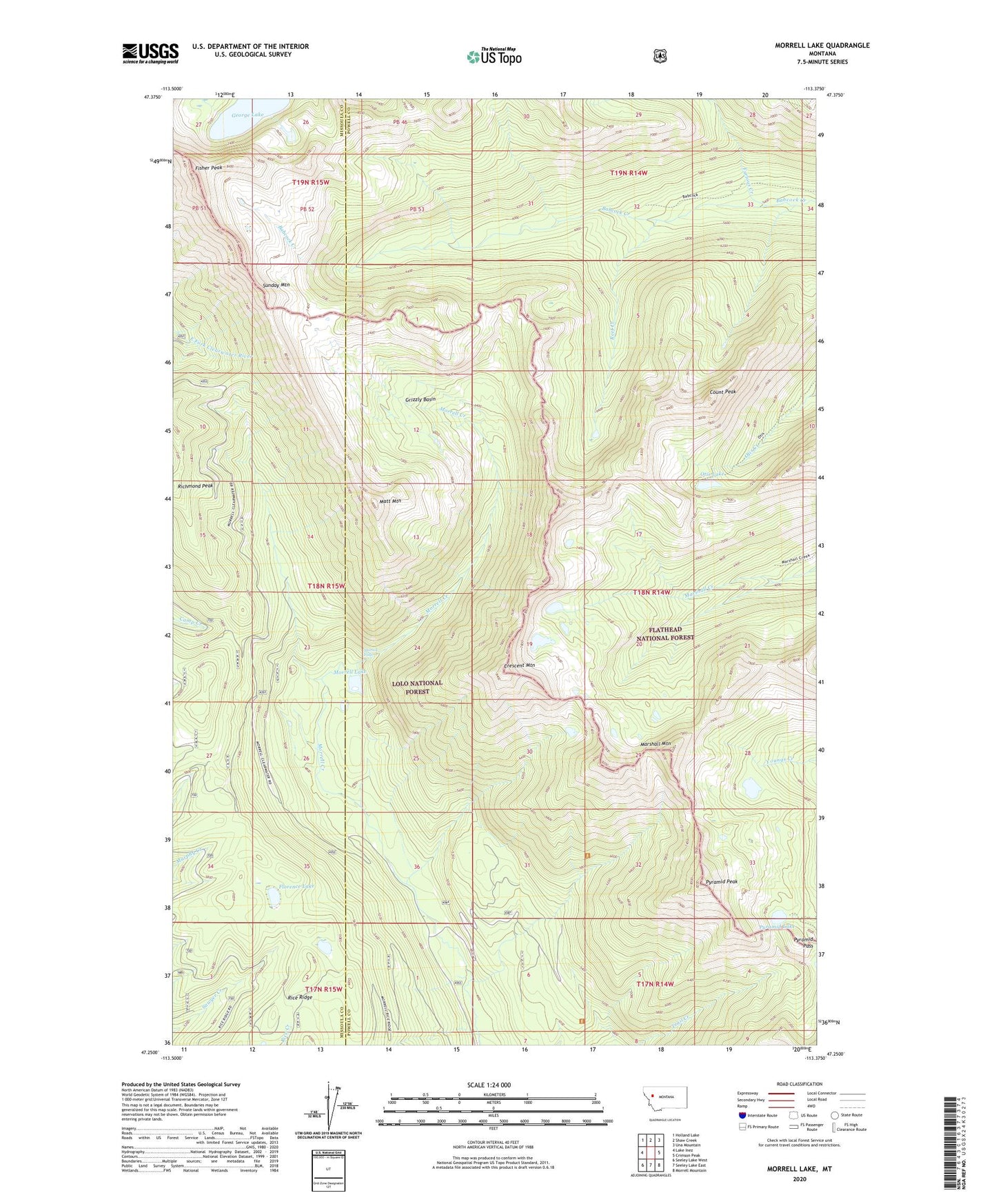
2024 topographic map quadrangle Morrell Lake in the state of Montana. Scale: 1:24000. Based on the newly updated USGS 7.5' US Topo map series, this map is in the following counties: Powell, Missoula. The map contains contour data, water features, and other items you are used to seeing on USGS maps, but also has updated roads and other features. This is the next generation of topographic maps. Printed on high-quality waterproof paper with UV fade-resistant inks.
Quads adjacent to this one:
West: Lake Inez
Northwest: Holland Lake
North: Shaw Creek
Northeast: Una Mountain
East: Crimson Peak
Southeast: Morrell Mountain
South: Seeley Lake East
Southwest: Seeley Lake West
This map covers the same area as the classic USGS quad with code o47113c4.
Contains the following named places: Count Peak, Crescent Mountain, Fisher Peak, Florence Lake, Furious Creek, George Lake, Grizzly Basin, Marshall Mountain, Matt Mountain, Morrell Falls, Morrell Falls National Recreation Trail, Morrell Lake, Otis Lake, Pyramid Lake, Pyramid Pass, Pyramid Pass Trail, Pyramid Peak, Reef Creek, Richmond Peak, Sunday Mountain