MyTopo
Silver Bow Spring Montana US Topo Map
Couldn't load pickup availability
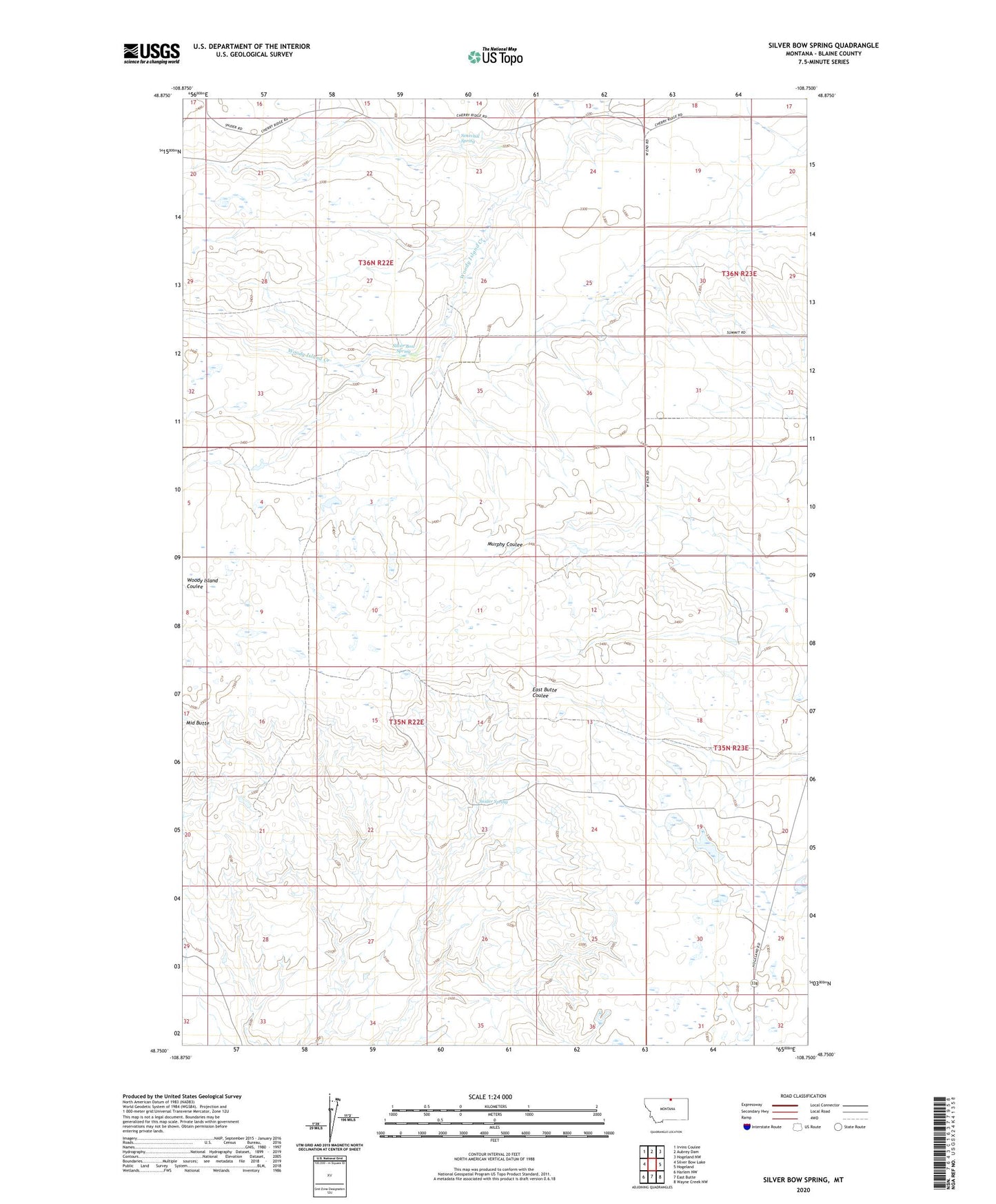
2024 topographic map quadrangle Silver Bow Spring in the state of Montana. Scale: 1:24000. Based on the newly updated USGS 7.5' US Topo map series, this map is in the following counties: Blaine. The map contains contour data, water features, and other items you are used to seeing on USGS maps, but also has updated roads and other features. This is the next generation of topographic maps. Printed on high-quality waterproof paper with UV fade-resistant inks.
Quads adjacent to this one:
West: Silver Bow Lake
Northwest: Irvins Coulee
North: Aubrey Dam
Northeast: Hogeland NW
East: Hogeland
Southeast: Wayne Creek NW
South: East Butte
Southwest: Harlem NW
This map covers the same area as the classic USGS quad with code o48108g7.
Contains the following named places: BR-57 Dam, Murphy Coulee School, Reed School, Senechal Spring, Silver Bow Spring, Snider School, Snider Spring, West End School