MyTopo
Silver City Montana US Topo Map
Couldn't load pickup availability
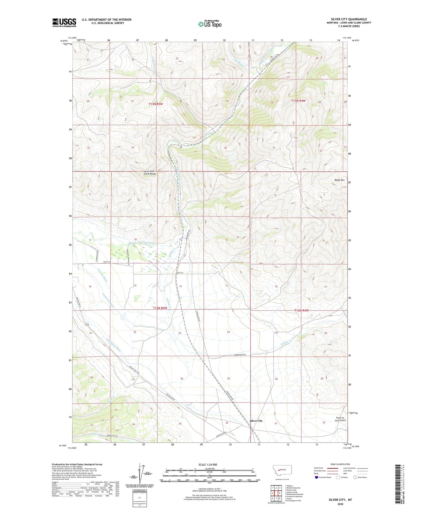
2024 topographic map quadrangle Silver City in the state of Montana. Scale: 1:24000. Based on the newly updated USGS 7.5' US Topo map series, this map is in the following counties: Lewis and Clark. The map contains contour data, water features, and other items you are used to seeing on USGS maps, but also has updated roads and other features. This is the next generation of topographic maps. Printed on high-quality waterproof paper with UV fade-resistant inks.
Quads adjacent to this one:
West: Canyon Creek
Northwest: Wilborn
North: Mitchell Mountain
Northeast: Sheep Creek
East: Rattlesnake Mountain
Southeast: Scratchgravel Hills
South: Austin
Southwest: Greenhorn Mountain
This map covers the same area as the classic USGS quad with code o46112g2.
Contains the following named places: Argo Millsite, Baldy Mountain, Bayliss, Big Sheep Creek, Canyon Creek School, Chevallier Ranch, Gans Klein Ditch, Johns, Justisson Ditch, Little Sheep Creek, Marysville Junction, Silver City, Silver Post Office, Silver School, Trinity, Trinity Creek, Vincent Ditch, Willow Creek