MyTopo
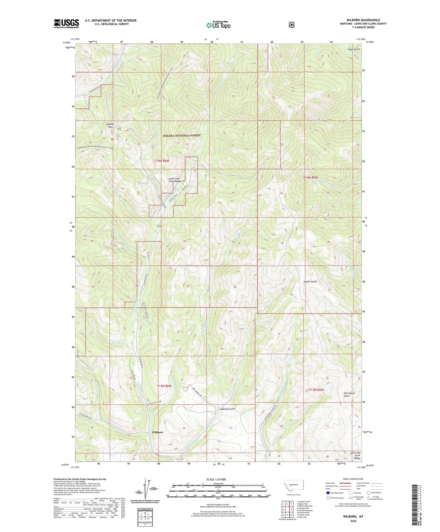
Wilborn Montana US Topo Map
Couldn't load pickup availability
Also explore the Wilborn Forest Service Topo of this same quad for updated USFS data
2024 topographic map quadrangle Wilborn in the state of Montana. Scale: 1:24000. Based on the newly updated USGS 7.5' US Topo map series, this map is in the following counties: Lewis and Clark. The map contains contour data, water features, and other items you are used to seeing on USGS maps, but also has updated roads and other features. This is the next generation of topographic maps. Printed on high-quality waterproof paper with UV fade-resistant inks.
Quads adjacent to this one:
West: Stemple Pass
Northwest: Cadotte Creek
North: Rogers Pass
Northeast: Roberts Mountain
East: Mitchell Mountain
Southeast: Silver City
South: Canyon Creek
Southwest: Granite Butte
This map covers the same area as the classic USGS quad with code o46112h3.
Contains the following named places: Bear Gulch, Flesher Pass, Little Mill Creek, Sawmill Gulch, Specimen Creek, Strom, Tar Head Creek, Trout Creek, Virginia Creek, Weino Creek, Wilborn, Wilborn Post Office, Wilborn School