MyTopo
Sheep Creek Montana US Topo Map
Couldn't load pickup availability
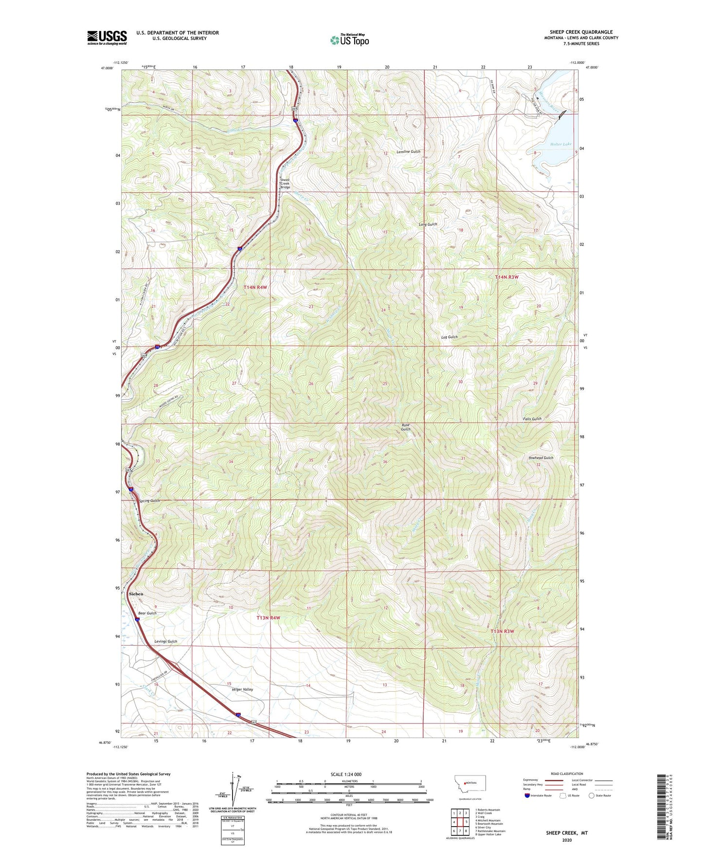
2024 topographic map quadrangle Sheep Creek in the state of Montana. Scale: 1:24000. Based on the newly updated USGS 7.5' US Topo map series, this map is in the following counties: Lewis and Clark. The map contains contour data, water features, and other items you are used to seeing on USGS maps, but also has updated roads and other features. This is the next generation of topographic maps. Printed on high-quality waterproof paper with UV fade-resistant inks.
Quads adjacent to this one:
West: Mitchell Mountain
Northwest: Roberts Mountain
North: Wolf Creek
Northeast: Craig
East: Beartooth Mountain
Southeast: Upper Holter Lake
South: Rattlesnake Mountain
Southwest: Silver City
This map covers the same area as the classic USGS quad with code o46112h1.
Contains the following named places: Bear Gulch, Central Montana Railroad Historical Marker, Clark Creek, Gleason, Holter Dam, Holter Post Office, Levings Gulch, Lichen Cliff Fishing Access Site, Little Creek, Lyons Creek Rest Area, Main Fork Little Creek, Manila, Middle Fork Little Creek, North Fork Little Creek, Oxbow Landing Strip, Oxbow Ranch, Prickly Pear Fishing Access Site, Rose Gulch, SE NE Section 10 Mine, SE SE Section 4 Mine, Sheep Creek, Sheep Creek Bridge, Sheep Creek Mine, Sieben Ranch, Spring Gulch, SW NW Section 14 Mine, Table Rock Fishing Access Site, West Sheep Creek, Wolf Creek Gaging Station, Wolf Creek Quarry, Wood Siding