MyTopo
Sourdough School Montana US Topo Map
Couldn't load pickup availability
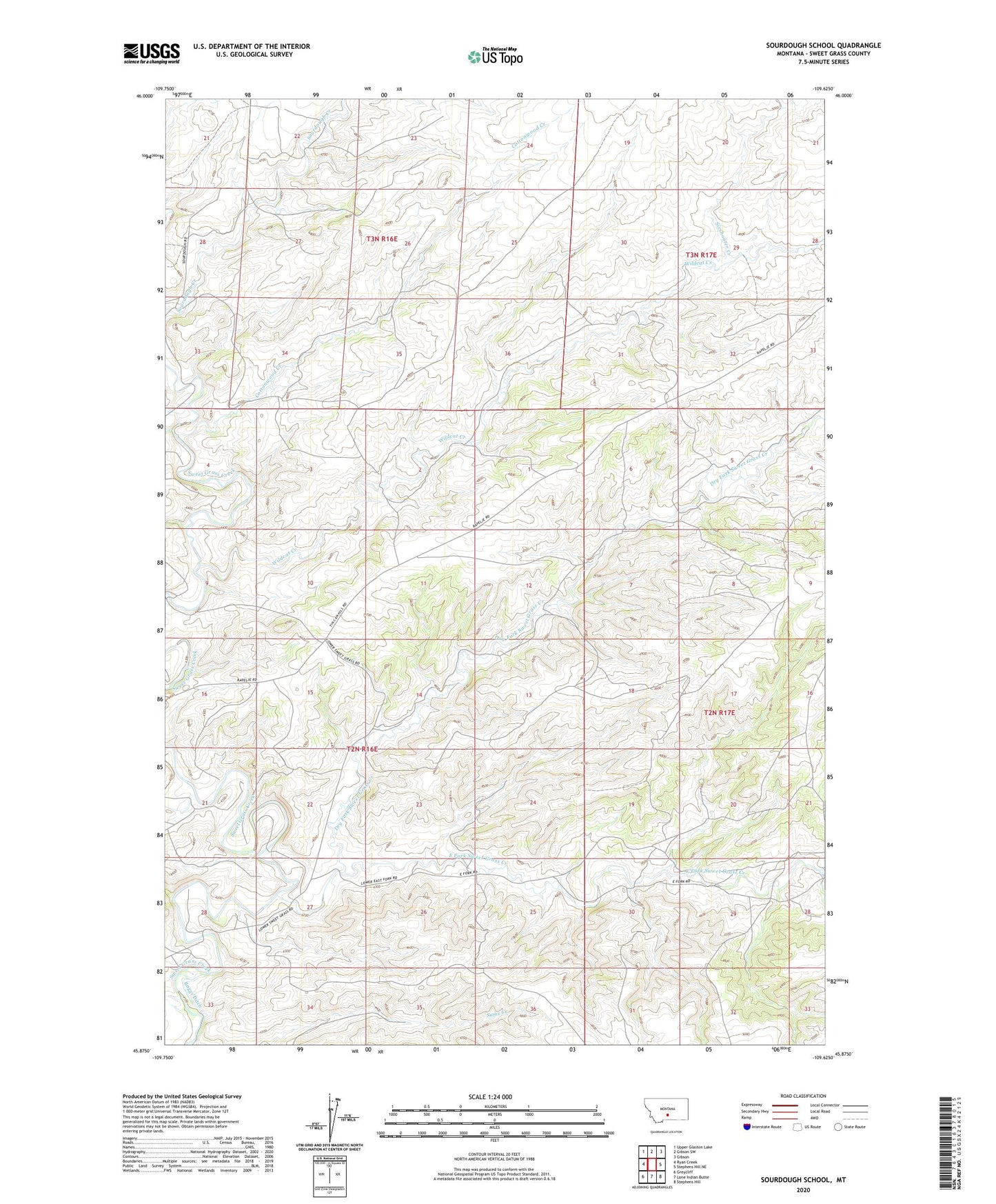
2024 topographic map quadrangle Sourdough School in the state of Montana. Scale: 1:24000. Based on the newly updated USGS 7.5' US Topo map series, this map is in the following counties: Sweet Grass. The map contains contour data, water features, and other items you are used to seeing on USGS maps, but also has updated roads and other features. This is the next generation of topographic maps. Printed on high-quality waterproof paper with UV fade-resistant inks.
Quads adjacent to this one:
West: Ryan Creek
Northwest: Upper Glaston Lake
North: Gibson SW
Northeast: Gibson
East: Stephens Hill NE
Southeast: Stephens Hill
South: Lone Indian Butte
Southwest: Greycliff
This map covers the same area as the classic USGS quad with code o45109h6.
Contains the following named places: 02N16E02____01 Well, 02N16E28____01 Well, 03N16E35DBAD01 Well, Cottonwood Creek, Dry Fork Sweet Grass Creek, East Fork School, East Fork Sweet Grass Creek, Gods Country Number 1 Dam, Sixshooter Creek, Sourdough School, Wildcat Creek