MyTopo
Ryan Creek Montana US Topo Map
Couldn't load pickup availability
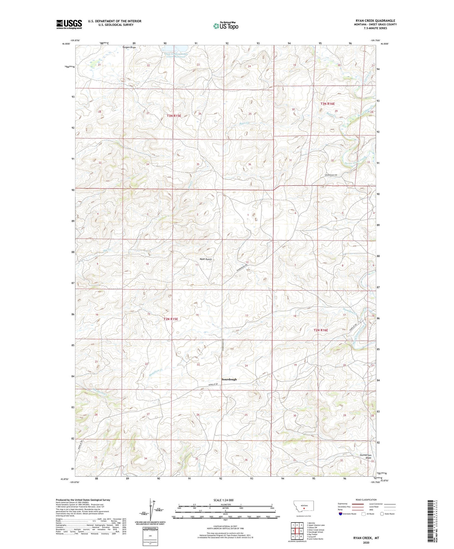
2024 topographic map quadrangle Ryan Creek in the state of Montana. Scale: 1:24000. Based on the newly updated USGS 7.5' US Topo map series, this map is in the following counties: Sweet Grass. The map contains contour data, water features, and other items you are used to seeing on USGS maps, but also has updated roads and other features. This is the next generation of topographic maps. Printed on high-quality waterproof paper with UV fade-resistant inks.
Quads adjacent to this one:
West: Otter Creek School
Northwest: Melville
North: Upper Glaston Lake
Northeast: Gibson SW
East: Sourdough School
Southeast: Lone Indian Butte
South: Greycliff
Southwest: Big Timber
This map covers the same area as the classic USGS quad with code o45109h7.
Contains the following named places: 02N15E23A___01 Well, 02N15E23BACC01 Well, 02N15E27____01 Well, 03N15E21____01 Well, 03N15E27DBBD01 Well, Carson Creek, First Creek Reservoir, Gunnerson Draw, Hamilton Creek, Holzhey Dam, Ryan Creek, Sourdough, Sourdough Creek, Walvoord Lake Dam