MyTopo
Greycliff Montana US Topo Map
Couldn't load pickup availability
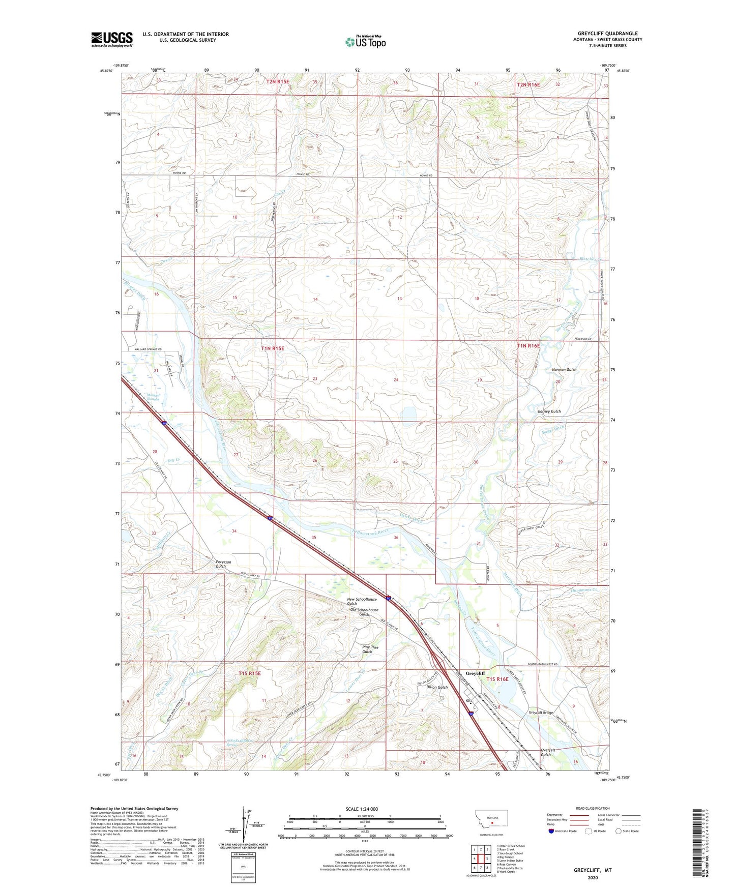
2024 topographic map quadrangle Greycliff in the state of Montana. Scale: 1:24000. Based on the newly updated USGS 7.5' US Topo map series, this map is in the following counties: Sweet Grass. The map contains contour data, water features, and other items you are used to seeing on USGS maps, but also has updated roads and other features. This is the next generation of topographic maps. Printed on high-quality waterproof paper with UV fade-resistant inks.
Quads adjacent to this one:
West: Big Timber
Northwest: Otter Creek School
North: Ryan Creek
Northeast: Sourdough School
East: Lone Indian Butte
Southeast: Work Creek
South: Packsaddle Butte
Southwest: Ross Canyon
This map covers the same area as the classic USGS quad with code o45109g7.
Contains the following named places: 01N15E10DBBD01 Well, 01N15E12C___01 Well, 01N15E21ADAC01 Well, 01N15E21BADA01 Well, 01N15E21DBBC01 Well, 01N15E33ABBC01 Well, 01N15E33ABBC02 Well, 01N16E08____01 Well, 01N16E08ADAA01 Well, 01N16E17____01 Well, 01N16E31____01 Well, 01S15E01DAAC01 Well, 01S15E02ABBA01 Well, 01S15E14BBBC01 Spring, 01S16E05____01 Well, 01S16E08____01 Well, 01S16E08BCBB01 Well, 01S16E08BDDB01 Well, Barney Gulch, Big Timber KOA Campground, Boe Ranch, Boggs Ditch, Cox Creek, Dillon Gulch, Dry Creek, Eatons Inn, Esp Ditch, Fletcher Creek, Greycliff, Greycliff Bridge, Greycliff Census Designated Place, Greycliff Post Office, Greycliff Prairie Dog Town, Greycliff Prairie Dog Town State Park, Greycliff School, Hangmans Creek, Harrison, Harrison Ditch, Hawks Ditch, Howie Post Office, Howie School, Lower Deer Creek, Milligan Creek, Milliken Sloughs, New Schoolhouse Gulch, Norman Gulch, Old Schoolhouse Gulch, Overfelt Gulch, Pelican Fishing Access Site, Peterson Gulch, Pine Tree Gulch, Pioneer Dam, Reynolds, Spring Creek, Sweet Grass Creek, Upper Deer Creek