MyTopo
Spring Gulch Montana US Topo Map
Couldn't load pickup availability
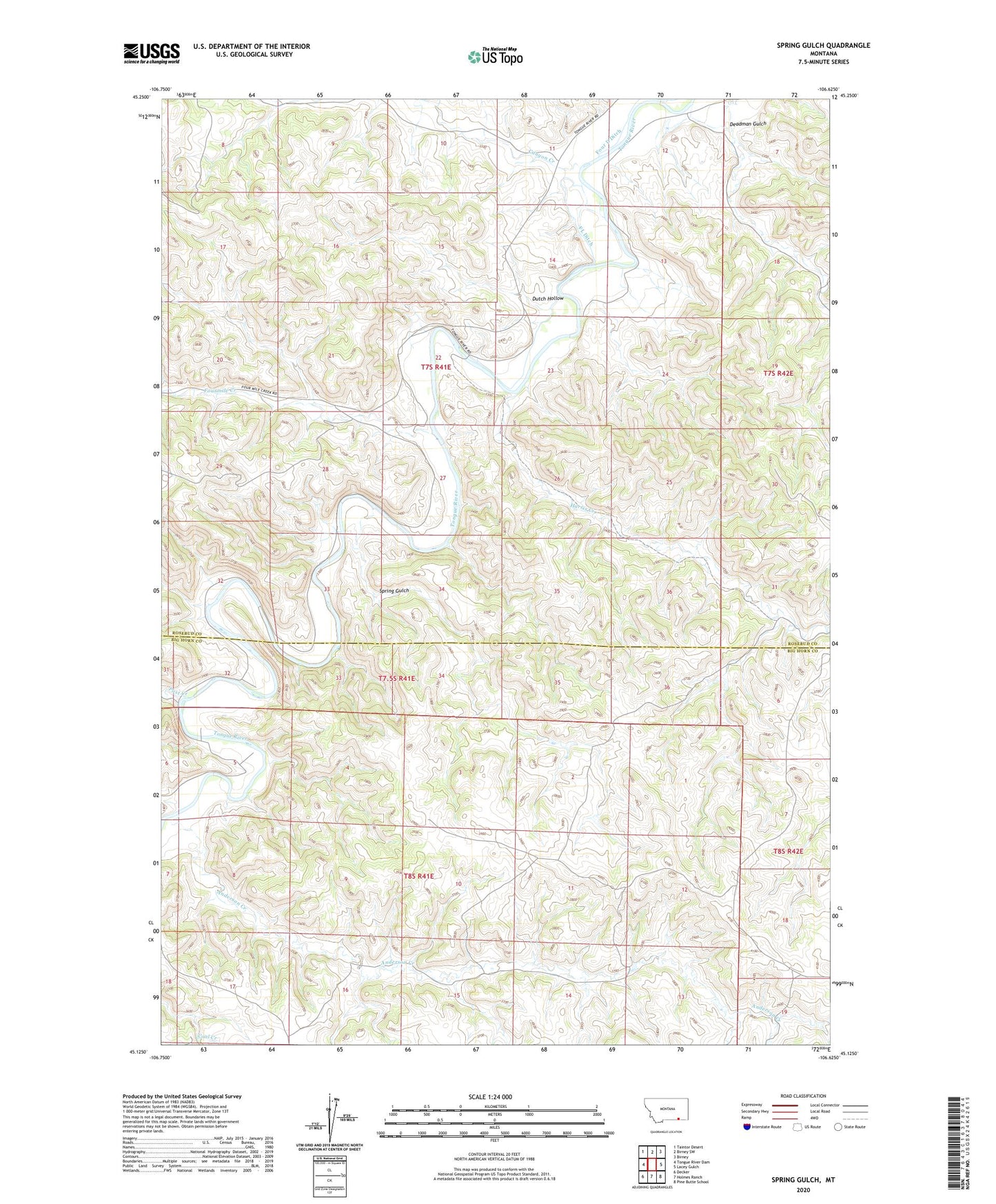
2024 topographic map quadrangle Spring Gulch in the state of Montana. Scale: 1:24000. Based on the newly updated USGS 7.5' US Topo map series, this map is in the following counties: Rosebud, Big Horn. The map contains contour data, water features, and other items you are used to seeing on USGS maps, but also has updated roads and other features. This is the next generation of topographic maps. Printed on high-quality waterproof paper with UV fade-resistant inks.
Quads adjacent to this one:
West: Tongue River Dam
Northwest: Taintor Desert
North: Birney SW
Northeast: Birney
East: Lacey Gulch
Southeast: Pine Butte School
South: Holmes Ranch
Southwest: Decker
This map covers the same area as the classic USGS quad with code o45106b6.
Contains the following named places: 07S41E11____01 Well, 07S41E22ACDC01 Well, 07S41E22CDCD01 Well, 07S41E27DBBD01 Well, 07S41E27DBCB01 Well, 07S41E28DDAD01 Well, 07S41E33CAAB01 Well, 07S41E34BAAD01 Well, 08S42E06ADBA01 Well, Anderson Creek, Canyon Creek, Canyon Creek School, Deadman Gulch, Decker Division, Dutch Hollow, FL Ditch, Flying V Ditch, Four Mile School, Fourmile Creek, Harris Creek, Post Creek, Spring Gulch