MyTopo
Augusta Montana US Topo Map
Couldn't load pickup availability
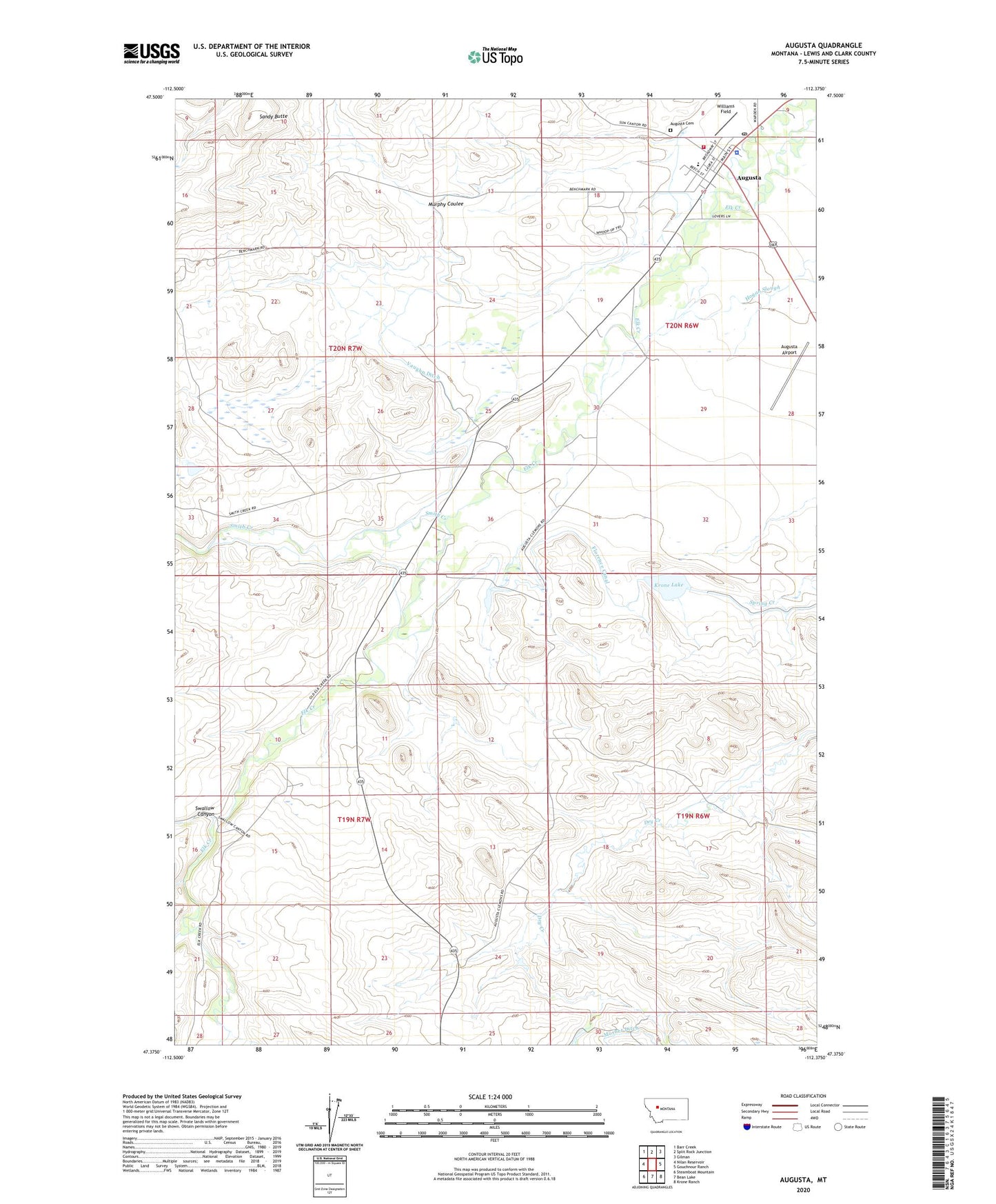
2024 topographic map quadrangle Augusta in the state of Montana. Scale: 1:24000. Based on the newly updated USGS 7.5' US Topo map series, this map is in the following counties: Lewis and Clark. The map contains contour data, water features, and other items you are used to seeing on USGS maps, but also has updated roads and other features. This is the next generation of topographic maps. Printed on high-quality waterproof paper with UV fade-resistant inks.
Quads adjacent to this one:
West: Nilan Reservoir
Northwest: Barr Creek
North: Split Rock Junction
Northeast: Gilman
East: Gouchnour Ranch
Southeast: Krone Ranch
South: Bean Lake
Southwest: Steamboat Mountain
This map covers the same area as the classic USGS quad with code o47112d4.
Contains the following named places: 20N06W17DDAA01 Well, Anderson Ranch, Augusta, Augusta Airport, Augusta Cemetery, Augusta Census Designated Place, Augusta Community Church, Augusta Community Library, Augusta Post Office, Augusta Public Schools, Augusta Volunteer Fire Department, Blubber Creek, Bohler Ranch, Chisholm Ranch, Converse Ranch, Country Bible Church, Gourley Ranch, Key Ranch, Krone Lake, Lewis and Clark County Sheriff's Office - Augusta Substation, Miller Ranch, Mills Ranch, Mirehouse Ranch, Montana Wilderness School, Mosher Ditch, Mosher Ranch, Murphy Coulee, Ogden Ranch, Saint Matthias Mission, Sandy Butte, Schlepp Ranch, Smith Creek, Southvale Post Office, Swallow Canyon, Vaughn Ditch, Wagons West Campground, Williams Field