MyTopo
Stephens Hill Montana US Topo Map
Couldn't load pickup availability
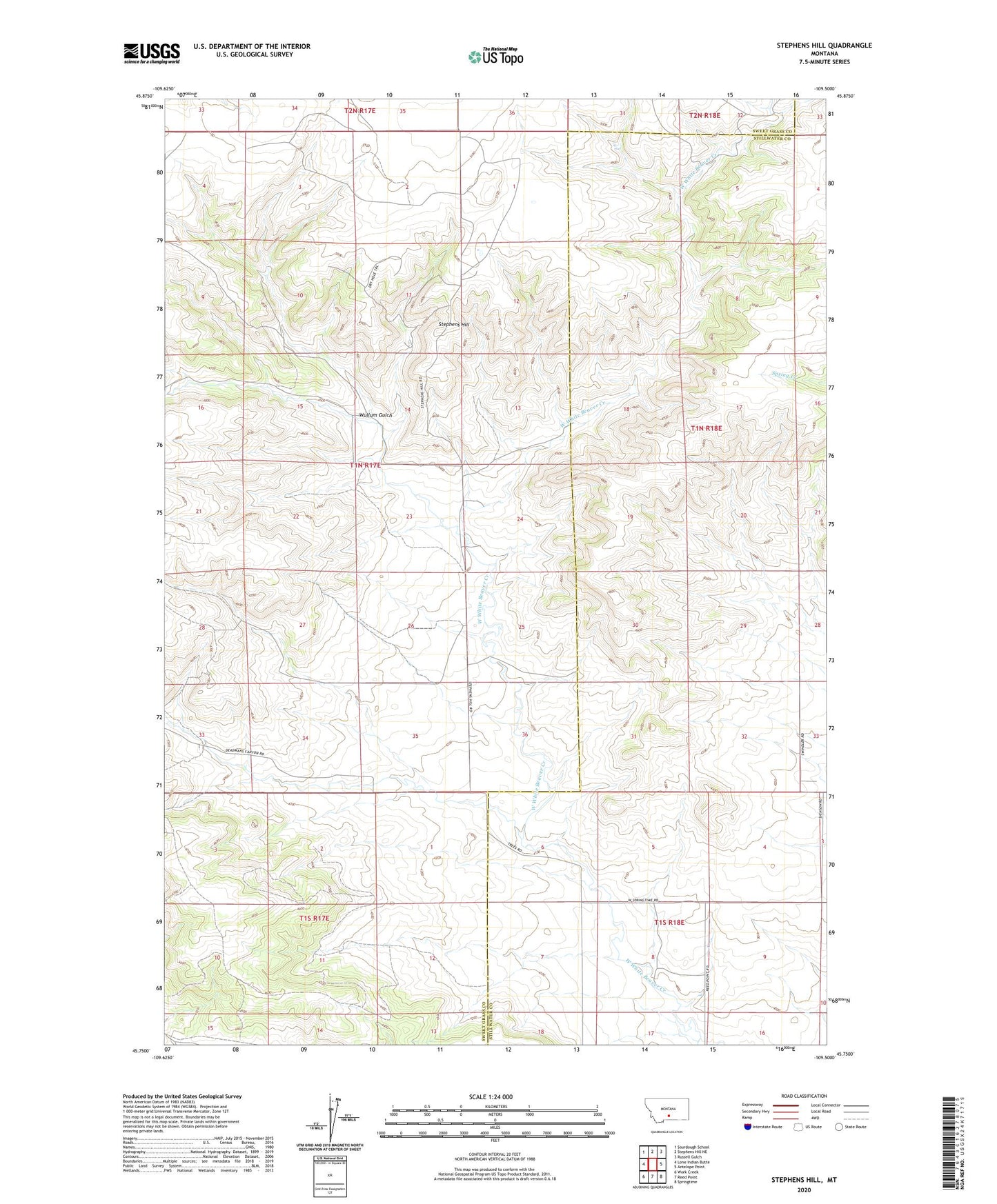
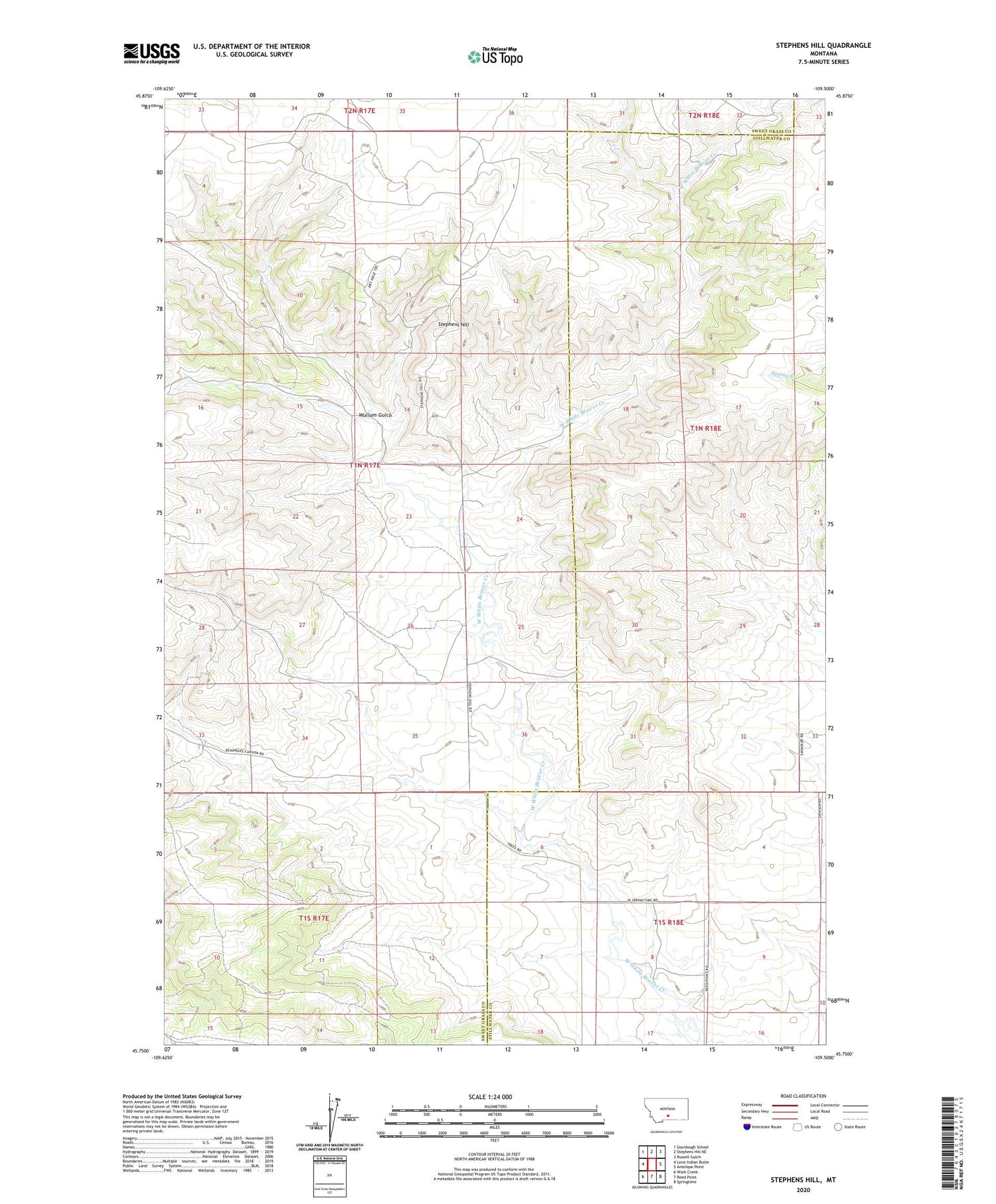
2020 topographic map quadrangle Stephens Hill in the state of Montana. Scale: 1:24000. Based on the newly updated USGS 7.5' US Topo map series, this map is in the following counties: Sweet Grass, Stillwater. The map contains contour data, water features, and other items you are used to seeing on USGS maps, but also has updated roads and other features. This is the next generation of topographic maps. Printed on high-quality waterproof paper with UV fade-resistant inks.
Quads adjacent to this one:
West: Lone Indian Butte
Northwest: Sourdough School
North: Stephens Hill NE
Northeast: Russell Gulch
East: Antelope Point
Southeast: Springtime
South: Reed Point
Southwest: Work Creek
Contains the following named places: 01N17E25C___01 Well, 01N18E33CCDC01 Well, 01S17E02ABCD01 Well, 02N18E06AACA01 Well, 59069, Stephens Hill, White Beaver Station, Wullum Gulch