
MyTopo
Strouf Island Montana US Topo Map
Couldn't load pickup availability
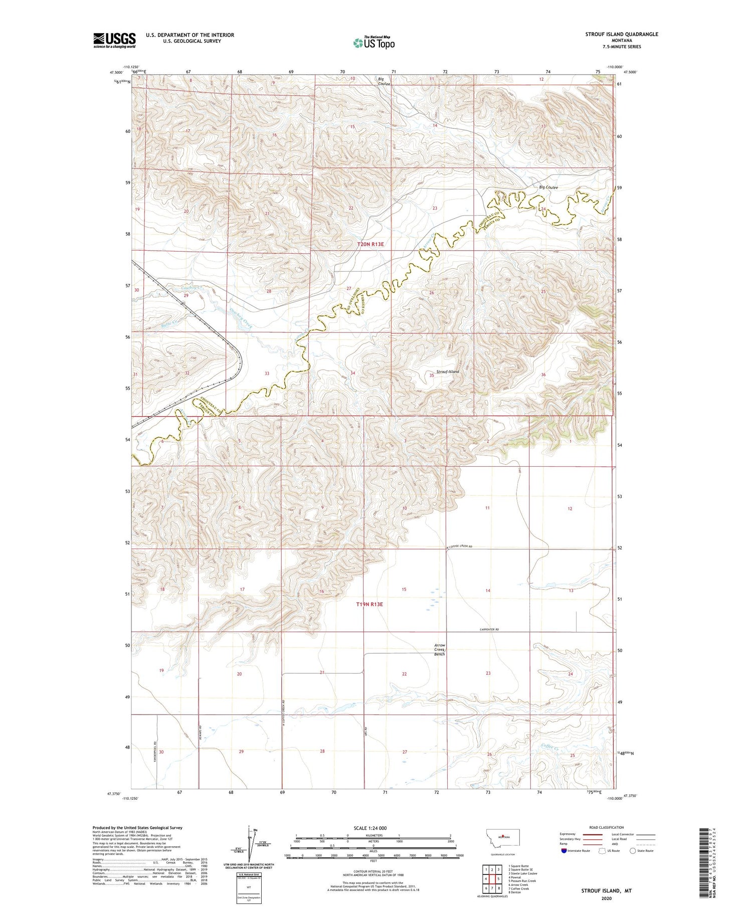
2020 topographic map quadrangle Strouf Island in the state of Montana. Scale: 1:24000. Based on the newly updated USGS 7.5' US Topo map series, this map is in the following counties: Fergus, Chouteau. The map contains contour data, water features, and other items you are used to seeing on USGS maps, but also has updated roads and other features. This is the next generation of topographic maps. Printed on high-quality waterproof paper with UV fade-resistant inks.
Quads adjacent to this one:
West: Pownal
Northwest: Square Butte
North: Square Butte SE
Northeast: Steele Lake Coulee
East: Possum Run Creek
Southeast: Denton
South: Coffee Creek
Southwest: Arrow Creek
Contains the following named places: 19N13E01DA__01 Well, 19N13E12CDC_01 Well, 19N13E22BAC_01 Well, 19N13E22BBDA01 Well, 19N13E29AAAA01 Well, 19N13E29BABB01 Well, 19N13E29BCAA01 Well, 19N13E29BCBD01 Well, 19N13E29BCCC01 Well, 19N14E07BCB_01 Well, 20N13E20CACA01 Well, 20N13E25BAAA01 Well, 20N13E26AAD_01 Well, 20N13E27ABC_01 Well, Arrow Creek Bench, Big Coulee, Butte Creek, Cafe Mocha Dam, Coffee Mate Dam, Cowboy Creek, Dieanira Dam, Strouf Island, White Arrow School


