MyTopo
Square Butte Montana US Topo Map
Couldn't load pickup availability
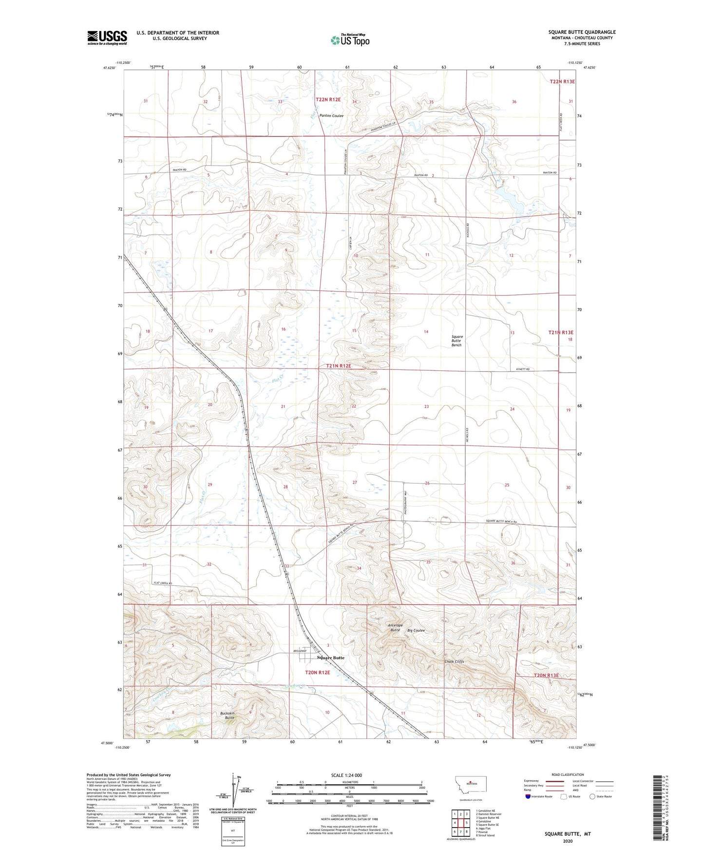
2024 topographic map quadrangle Square Butte in the state of Montana. Scale: 1:24000. Based on the newly updated USGS 7.5' US Topo map series, this map is in the following counties: Chouteau. The map contains contour data, water features, and other items you are used to seeing on USGS maps, but also has updated roads and other features. This is the next generation of topographic maps. Printed on high-quality waterproof paper with UV fade-resistant inks.
Quads adjacent to this one:
West: Geraldine
Northwest: Geraldine NE
North: Dammel Reservoir
Northeast: Square Butte NE
East: Square Butte SE
Southeast: Strouf Island
South: Pownal
Southwest: Jiggs Flat
This map covers the same area as the classic USGS quad with code o47110e2.
Contains the following named places: 09N12E23DCBA01 Well, 21N12E15BDB_01 Well, 21N12E28CDA_01 Well, 21N13E07BBBC01 Well, 22N12E32DCD_01 Well, 59446, Antelope Butte, Buckskin Butte, Chalk Cliffs, Panton Coulee, Panton Coulee Reservoir, Phantom Coulee Reservoir Dam, Square Butte, Square Butte Census Designated Place, Square Butte Post Office, Square Butte School