MyTopo
Sunburst Lake Montana US Topo Map
Couldn't load pickup availability
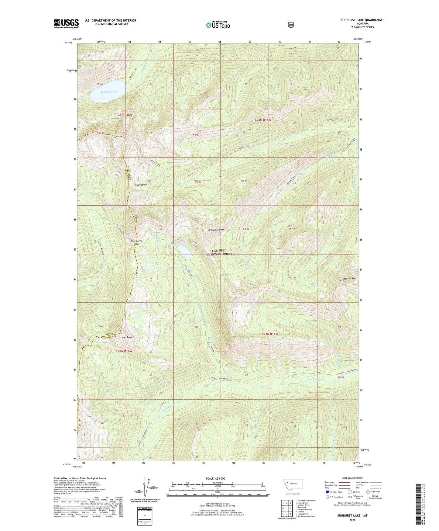
2020 topographic map quadrangle Sunburst Lake in the state of Montana. Scale: 1:24000. Based on the newly updated USGS 7.5' US Topo map series, this map is in the following counties: Flathead, Lake. The map contains contour data, water features, and other items you are used to seeing on USGS maps, but also has updated roads and other features. This is the next generation of topographic maps. Printed on high-quality waterproof paper with UV fade-resistant inks.
Quads adjacent to this one:
West: Swan Peak
Northwest: Thunderbolt Mountain
North: String Creek
Northeast: Meadow Creek
East: Marmot Mountain
Southeast: Big Salmon Lake West
South: Holland Peak
Southwest: Condon
Contains the following named places: Cannon Creek, Combat Creek, Gill Creek, Highrock Creek, Lion Creek Pass, Lion Creek Trail, Oreamnos Peak, Owl Peak, Palisade Creek, Palisade Lake, Stadium Peak, Sunburst Lake, Trickle Creek