MyTopo
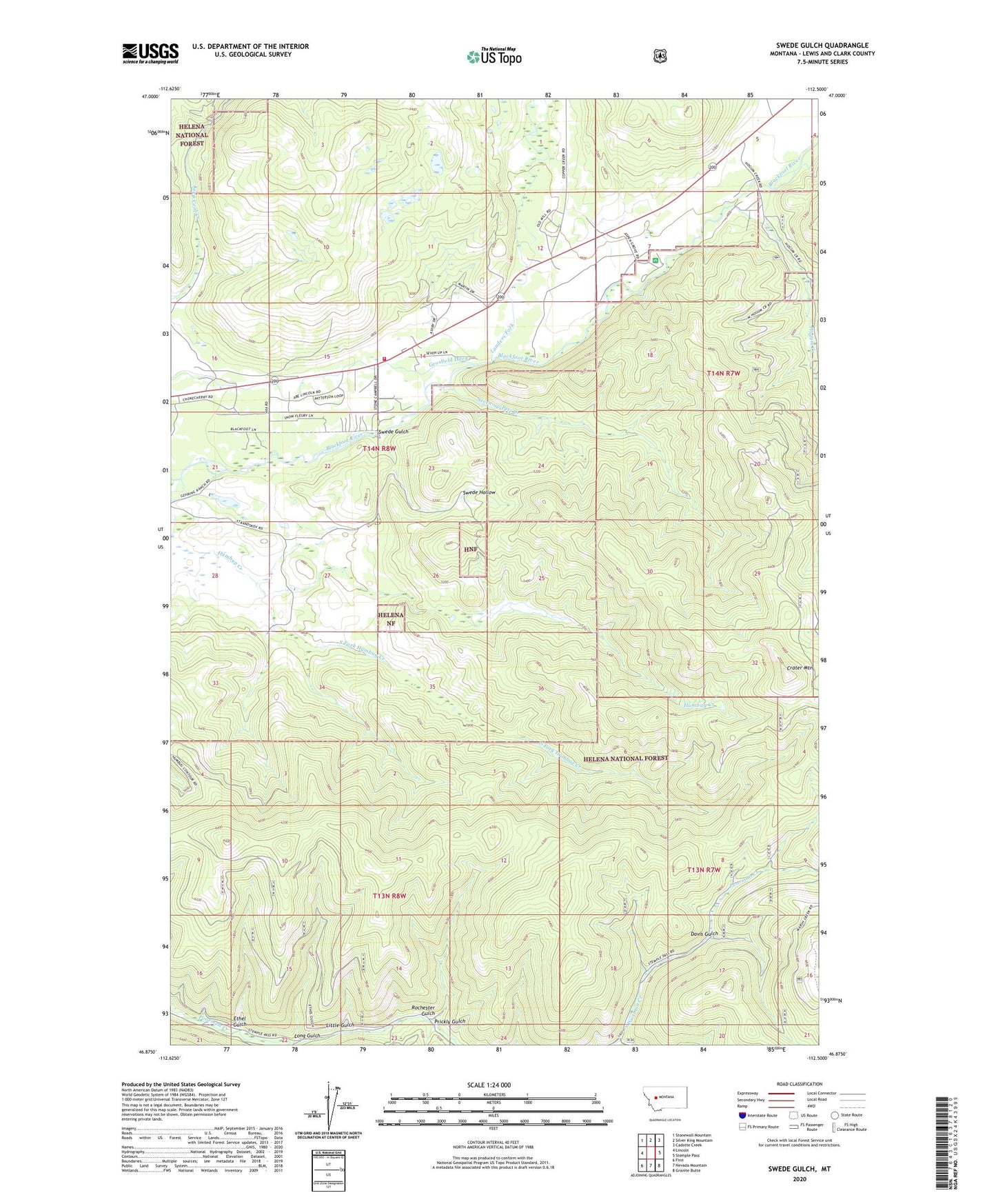
Swede Gulch Montana US Topo Map
Couldn't load pickup availability
Also explore the Swede Gulch Forest Service Topo of this same quad for updated USFS data
2024 topographic map quadrangle Swede Gulch in the state of Montana. Scale: 1:24000. Based on the newly updated USGS 7.5' US Topo map series, this map is in the following counties: Lewis and Clark. The map contains contour data, water features, and other items you are used to seeing on USGS maps, but also has updated roads and other features. This is the next generation of topographic maps. Printed on high-quality waterproof paper with UV fade-resistant inks.
Quads adjacent to this one:
West: Lincoln
Northwest: Stonewall Mountain
North: Silver King Mountain
Northeast: Cadotte Creek
East: Stemple Pass
Southeast: Granite Butte
South: Nevada Mountain
Southwest: Finn
This map covers the same area as the classic USGS quad with code o46112h5.
Contains the following named places: 14N07W05CAC_01 Well, 14N07W05CDA_01 Well, 14N07W05CDD_01 Well, 14N07W05CDD_02 Well, 14N08W22BBAD01 Well, 14N08W22BBD_01 Well, Annis Post Office, Aspen Grove Campground, Black Diamond Creek, Columbia Mine, Crater Mountain, Davis Gulch, Delany Mill, Ethel Gulch, Grosfield Ditch, Hogum Creek, Humbug Creek, Landers Fork, Last Chance Mine, Lincoln Community Ambulance Service Station 3, Lincoln Division, Lincoln Rural Fire District Station 3, Little Gulch, Long Gulch, Mill Site Mine, NW NW Section 18 Mine, Prickly Gulch, Ripley Mill, Rochester Gulch, Rochester Post Office, Rover Mine, SE NE Section 8 Mine, SE SW Section 4 Mine, Seven Up Pete Mine, Seven Up Pete Ranch, Seven-up-Pete Creek, Silver Beel Mine, Silver Bell Mine, South Fork Humbug Creek, SW SE Section 8 Mine, Swansea Mine, Swansea Tailings, Swede Gulch, Swede Hollow