MyTopo
Stemple Pass Montana US Topo Map
Couldn't load pickup availability
Also explore the Stemple Pass Forest Service Topo of this same quad for updated USFS data
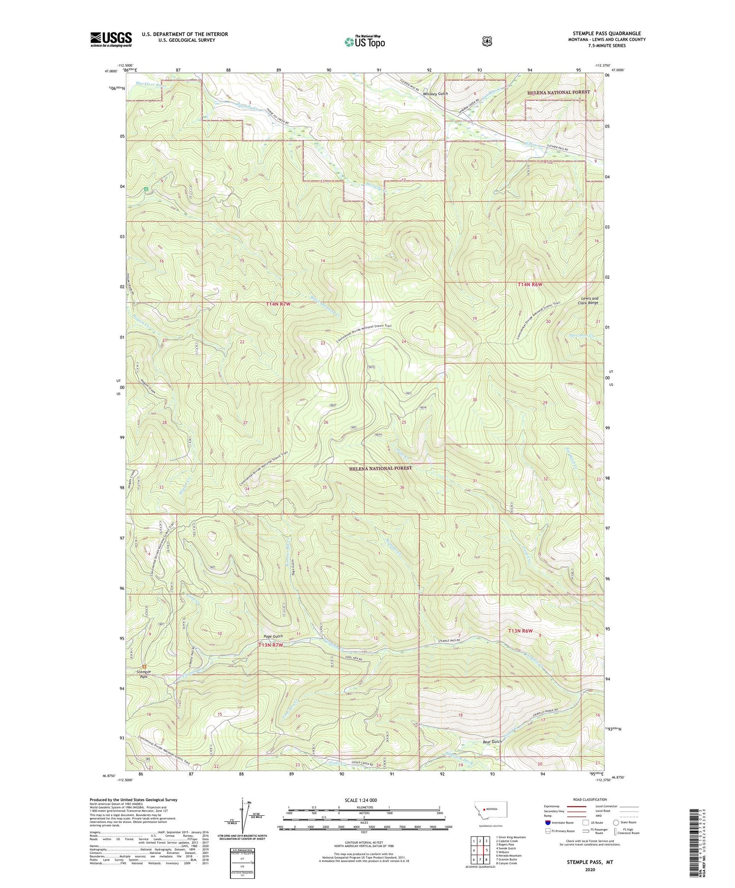
2024 topographic map quadrangle Stemple Pass in the state of Montana. Scale: 1:24000. Based on the newly updated USGS 7.5' US Topo map series, this map is in the following counties: Lewis and Clark. The map contains contour data, water features, and other items you are used to seeing on USGS maps, but also has updated roads and other features. This is the next generation of topographic maps. Printed on high-quality waterproof paper with UV fade-resistant inks.
Quads adjacent to this one:
West: Swede Gulch
Northwest: Silver King Mountain
North: Cadotte Creek
Northeast: Rogers Pass
East: Wilborn
Southeast: Canyon Creek
South: Granite Butte
Southwest: Nevada Mountain
This map covers the same area as the classic USGS quad with code o46112h4.
Contains the following named places: Alpha-Omega Mine, Astor Mine, Bear Gulch, Flesher Pass Trail, Fool Hen Creek, Gold Creek, Gould, Gould Creek, Gould Post Office, Horsefly Creek, MS 9351 Mine, NE NW Section 13 Mine, Page Gulch, Pangewasset Mine, Rooster Bill Creek, Sandbar Creek, SE NE Section 16 Mine, SE SW Section 10 Mine, Stemple, Stemple Creek, Stemple Pass, Stemple Post Office, SW NW Section 15 Mine, Whiskey Gulch