MyTopo
Roscoe Montana US Topo Map
Couldn't load pickup availability
Also explore the Roscoe Forest Service Topo of this same quad for updated USFS data
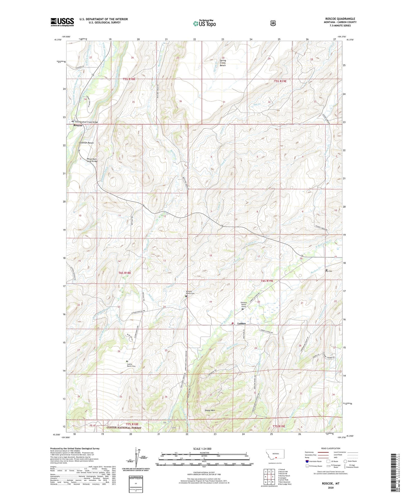
2024 topographic map quadrangle Roscoe in the state of Montana. Scale: 1:24000. Based on the newly updated USGS 7.5' US Topo map series, this map is in the following counties: Carbon. The map contains contour data, water features, and other items you are used to seeing on USGS maps, but also has updated roads and other features. This is the next generation of topographic maps. Printed on high-quality waterproof paper with UV fade-resistant inks.
Quads adjacent to this one:
West: Mackay Ranch
Northwest: Fishtail
North: Roscoe NW
Northeast: Roscoe NE
East: Castagne
Southeast: Red Lodge West
South: Bare Mountain
Southwest: Sylvan Peak
This map covers the same area as the classic USGS quad with code o45109c4.
Contains the following named places: 06S18E13CBAD01 Well, 06S19E34BBCC01 Well, Alex Boggio Place, Burnett Ranch, Burnett Ranch Cemetery, Burnt Fork Creek, Butcher Creek School, Canal K, Canal L, Canal O, Canal P, Charles Boggio Ranch, Dell Cut, East Fork Butcher Creek, East Fork West Red Lodge Creek, East Rosebud Creek Bridge, Elessens Ranch Grave, Ellis Creek, Espeland-Ostrum-George Ditch, Fairbanks Post Office, George Place, George-Dana Ditch, Hyem Ranch, Joe Boggio Ranch, Linley, Luoma Ranch, Luoma Ranch Cemetery, Luther, Luther Census Designated Place, Luther Post Office, Luther School, Main Canal, Old Dell Ranch, Old Kuhl Ranch, Peabody Ditch, Peterson Place, Plummer School, Rankin Place, Red Lodge Creek Guard Station, Red Lodge Rural Fire District 7 Luther Station, Roscoe, Roscoe Census Designated Place, Roscoe Post Office, Roscoe School, Simpkins Place, Spring Creek Bench, Stewart School, Tony Cemetery, Tony School, Volney Creek School, Weast Main Canal Bridge, West Fork Butcher Creek, Youngstrom Ranch