MyTopo
Tepee Butte NE Montana US Topo Map
Couldn't load pickup availability
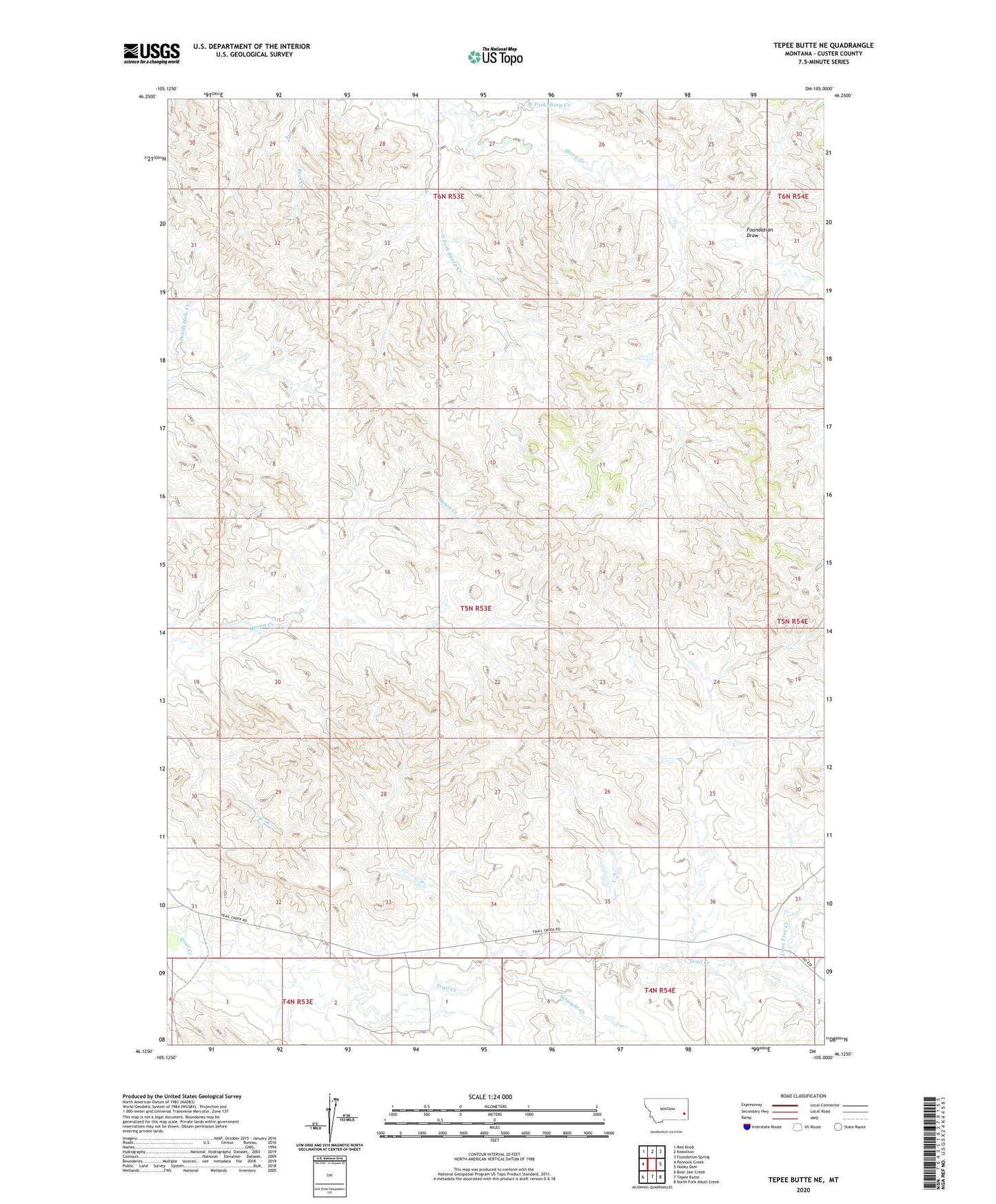
2024 topographic map quadrangle Tepee Butte NE in the state of Montana. Scale: 1:24000. Based on the newly updated USGS 7.5' US Topo map series, this map is in the following counties: Custer. The map contains contour data, water features, and other items you are used to seeing on USGS maps, but also has updated roads and other features. This is the next generation of topographic maps. Printed on high-quality waterproof paper with UV fade-resistant inks.
Quads adjacent to this one:
West: Pennock Creek
Northwest: Red Knob
North: Knowlton
Northeast: Foundation Spring
East: Hooky Dam
Southeast: North Fork Alkali Creek
South: Tepee Butte
Southwest: Bear Jaw Creek
This map covers the same area as the classic USGS quad with code o46105b1.
Contains the following named places: 04N53E01BB__01 Well, 04N53E01BCAD01 Well, 04N53E02BBB_01 Well, 04N53E02BBDC01 Well, 05N53E17DAAA01 Well, 05N53E19AACB01 Well, 05N53E19BACA01 Well, 05N53E25BACC01 Well, 05N53E33ADAA01 Well, 05N53E35CCBD01 Well, 05N54E32CCC_01 Well, 06N53E33AAAA01 Well, 06N53E35AAAA01 Well, Balsam Number 3 Dam, Foundation Draw, Lone Tree Creek, North Fork Sheep Creek, South Fork Sheep Creek, Straight Creek