
MyTopo
Thompson Pass Montana US Topo Map
Couldn't load pickup availability
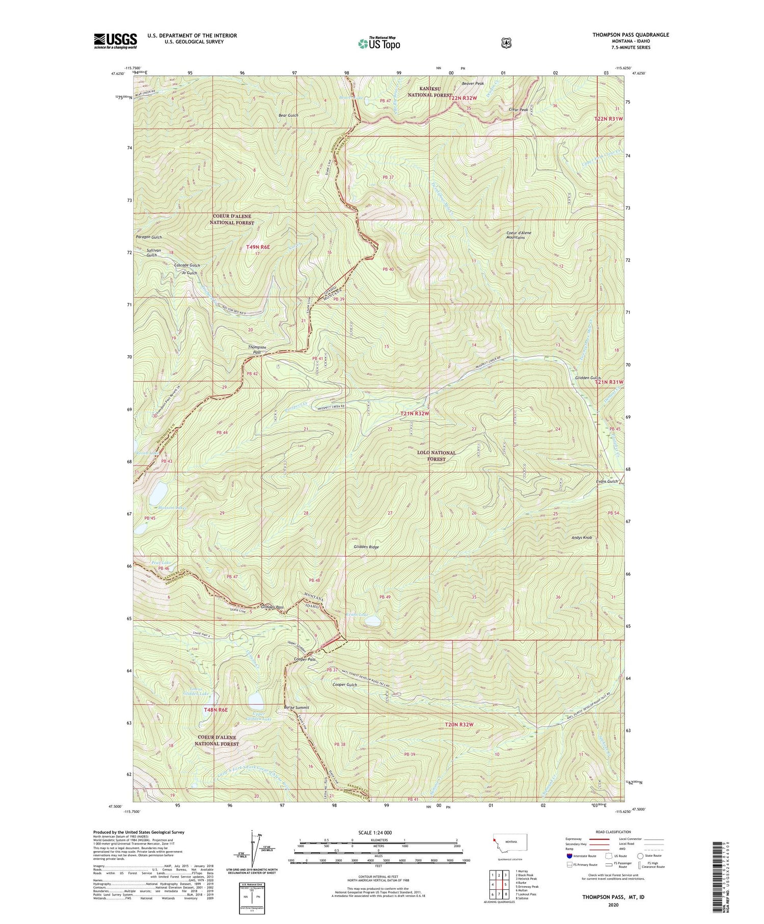
2020 topographic map quadrangle Thompson Pass in the states of Idaho, Montana. Scale: 1:24000. Based on the newly updated USGS 7.5' US Topo map series, this map is in the following counties: Sanders, Shoshone. The map contains contour data, water features, and other items you are used to seeing on USGS maps, but also has updated roads and other features. This is the next generation of topographic maps. Printed on high-quality waterproof paper with UV fade-resistant inks.
Quads adjacent to this one:
West: Burke
Northwest: Murray
North: Black Peak
Northeast: Helwick Peak
East: Driveway Peak
Southeast: Saltese
South: Lookout Pass
Southwest: Mullan
Contains the following named places: Andys Knob, Arlington Mine, Beaver Lake, Beaver Peak, Blossom Lakes, Bull Frog Mine, Burke Summit, Cascade Gulch, Cat Creek, Chipmunk Creek, Clear Peak, Cooper Creek Mine, Cooper Pass, Demont Creek, Evans Gulch, Evans Lake, Glidden Gulch, Glidden Pass, Glidden Ridge, Halfway House Historical Site, Halfway House Historical SIte, Jo Gulch, Lower Glidden Lake, Pear Lake, Sonju Mine, Spokane Creek, Sullivan Gulch, Summit Creek, Thompson Pass, Twentyfour Mile Creek, Twentythree Mile Creek, Upper Glidden Lake


