MyTopo
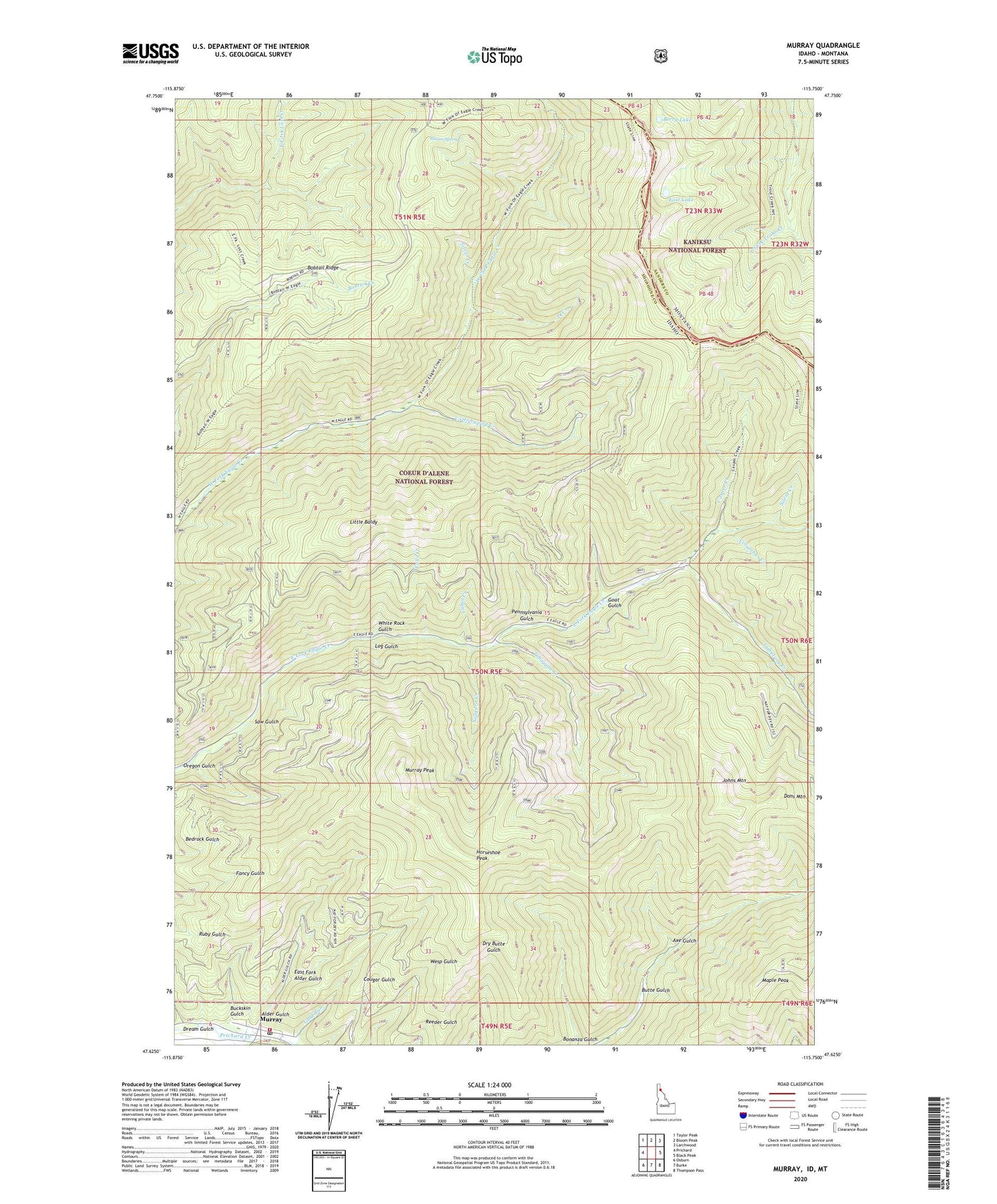
Murray Idaho US Topo Map
Couldn't load pickup availability
Also explore the Murray Forest Service Topo of this same quad for updated USFS data
2024 topographic map quadrangle Murray in the states of Idaho, Montana. Scale: 1:24000. Based on the newly updated USGS 7.5' US Topo map series, this map is in the following counties: Shoshone, Sanders. The map contains contour data, water features, and other items you are used to seeing on USGS maps, but also has updated roads and other features. This is the next generation of topographic maps. Printed on high-quality waterproof paper with UV fade-resistant inks.
Quads adjacent to this one:
West: Prichard
Northwest: Taylor Peak
North: Bloom Peak
Northeast: Larchwood
East: Black Peak
Southeast: Thompson Pass
South: Burke
Southwest: Osburn
Contains the following named places: 34 Creek, 83874, Alder Gulch, Axe Gulch, Berry Lake, Bloom Spring, Bobtail Creek, Bobtail Ridge, Buckskin Gulch, Cabin Creek, Casper Creek, Columbus Creek, Cottonwood Creek, Dons Mountain, Dream Gulch, East Fork Alder Gulch, East Lake, Falls Creek, Goat Gulch, Horseshoe Peak, Jack Waite Forks, Johns Mountain, Little Baldy, Log Gulch, Maple Peak, Murray, Murray Peak, Murray Post Office, Niagara Creek, Oregon Gulch, Pennsylvania Gulch, Prichard / Murray Volunteer Fire Department, Saw Gulch, Silent Creek, Silver Creek, Snowshoe Creek, Toboggan Creek, Tributary Creek, White Rock Gulch