MyTopo
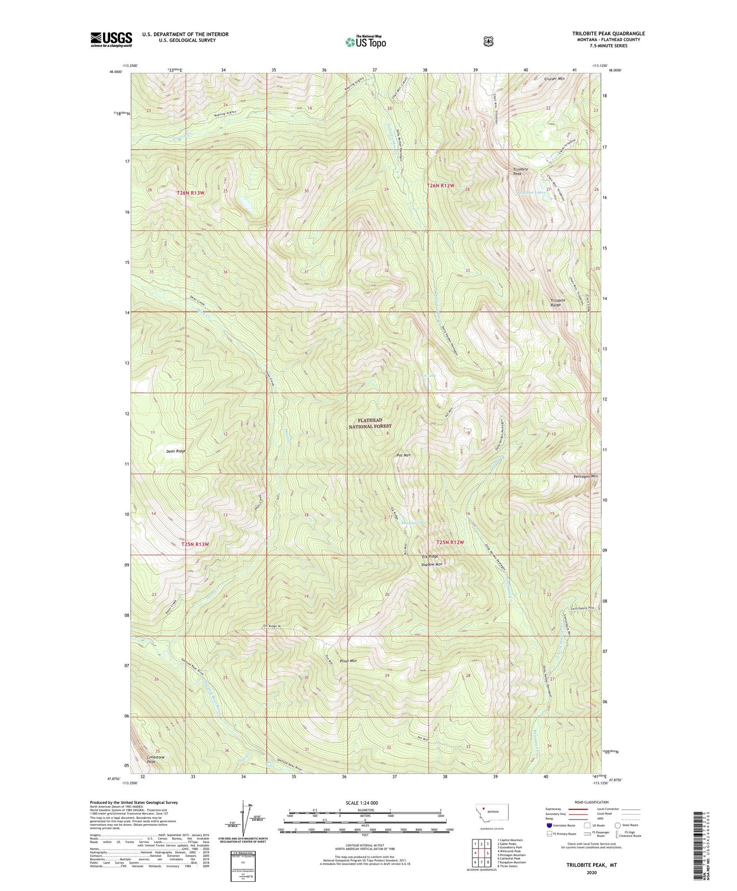
Trilobite Peak Montana US Topo Map
Couldn't load pickup availability
Also explore the Trilobite Peak Forest Service Topo of this same quad for updated USFS data
2024 topographic map quadrangle Trilobite Peak in the state of Montana. Scale: 1:24000. Based on the newly updated USGS 7.5' US Topo map series, this map is in the following counties: Flathead. The map contains contour data, water features, and other items you are used to seeing on USGS maps, but also has updated roads and other features. This is the next generation of topographic maps. Printed on high-quality waterproof paper with UV fade-resistant inks.
Quads adjacent to this one:
West: Whitcomb Peak
Northwest: Capitol Mountain
North: Gable Peaks
Northeast: Gooseberry Park
East: Pentagon Mountain
Southeast: Three Sisters
South: Bungalow Mountain
Southwest: Cathedral Peak
This map covers the same area as the classic USGS quad with code o47113h2.
Contains the following named places: Argosy Creek, Chair Mountain Trail, Cruiser Mountain, Dean Creek, Dean Creek Campsite, Dean Falls, East Fork Pentagon Creek, Elk Ridge, Limestone Peak, Pentagon Clack Creek Trail, Pivot Mountain, Pot Lake, Pot Mountain, Pot Mountain Lookout, Shadow Lake, Shadow Mountain, Slim Creek, Trilobite Lakes, Trilobite Peak, Trilobite Range, ZIP Code: 59919