MyTopo
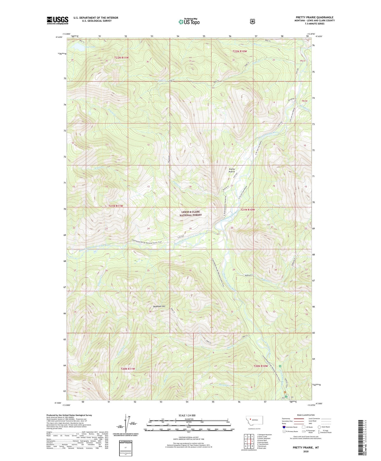
Pretty Prairie Montana US Topo Map
Couldn't load pickup availability
Also explore the Pretty Prairie Forest Service Topo of this same quad for updated USFS data
2024 topographic map quadrangle Pretty Prairie in the state of Montana. Scale: 1:24000. Based on the newly updated USGS 7.5' US Topo map series, this map is in the following counties: Lewis and Clark. The map contains contour data, water features, and other items you are used to seeing on USGS maps, but also has updated roads and other features. This is the next generation of topographic maps. Printed on high-quality waterproof paper with UV fade-resistant inks.
Quads adjacent to this one:
West: Prairie Reef
Northwest: Slategoat Mountain
North: Glenn Creek
Northeast: Arsenic Mountain
East: Patricks Basin
Southeast: Wood Lake
South: Benchmark
Southwest: Trap Mountain
This map covers the same area as the classic USGS quad with code o47112e8.
Contains the following named places: Bear Creek, Bear Lake, Bighead Creek, Burned Creek, Camp Allan, Deadman Hill, Deer Creek, Goat Creek, Nineteen Creek, Prairie Creek, Pretty Prairie, Pretty Prairie Guard Station, South Fork Campground, Straight Creek, Sun River Game Preserve, Wapiti Creek, West Fork Licks, West Fork South Fork Sun River, Windfall Creek