
MyTopo
Tucker Creek Montana US Topo Map
Couldn't load pickup availability
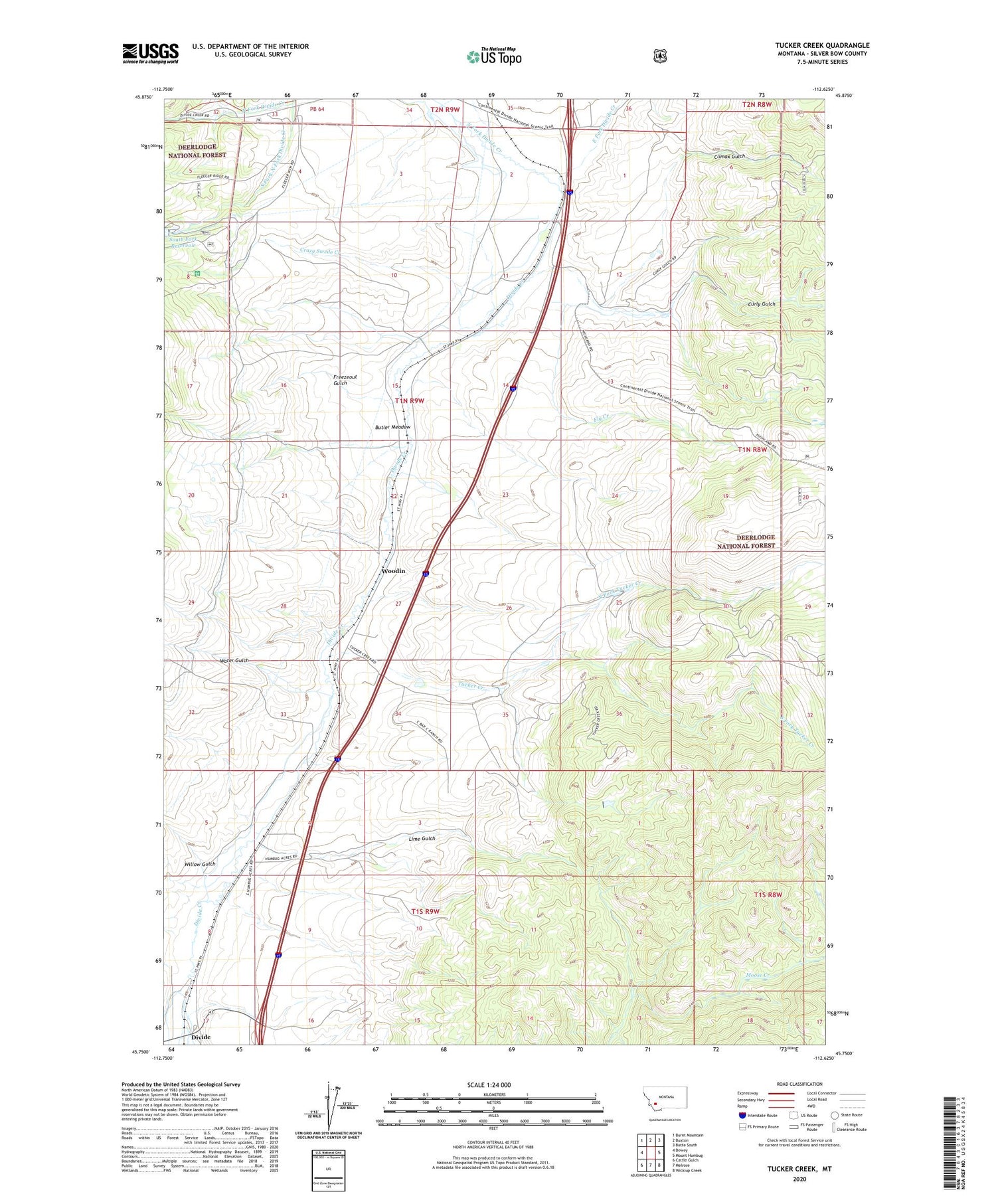
2020 topographic map quadrangle Tucker Creek in the state of Montana. Scale: 1:24000. Based on the newly updated USGS 7.5' US Topo map series, this map is in the following counties: Silver Bow. The map contains contour data, water features, and other items you are used to seeing on USGS maps, but also has updated roads and other features. This is the next generation of topographic maps. Printed on high-quality waterproof paper with UV fade-resistant inks.
Quads adjacent to this one:
West: Dewey
Northwest: Burnt Mountain
North: Buxton
Northeast: Butte South
East: Mount Humbug
Southeast: Wickiup Creek
South: Melrose
Southwest: Cattle Gulch
Contains the following named places: Beaudines, Butler Meadow, Butte-Silver Bow South Division, Climax Gulch, Crazy Swede Creek, Curly Gulch, Divide, Divide Rest Area, Dyers, East Fork Divide Creek, Feely School, Fleecer Mountain Wildlife Management Area, Fleecer Ranger Station, Fly Creek, Freezeout Gulch, Humbug Spires Primitive Area Historical Marker, Johnson, Lavell, Lime Gulch, Montana State Highway Department Section House, North Fork Divide Creek, North Fork Tucker Creek, South Fork North Fork Divide Creek, South Fork Reservoir Dam, South Fork Tucker Creek, Tucker Creek, Water Gulch, Willow Gulch, Woodin


