MyTopo
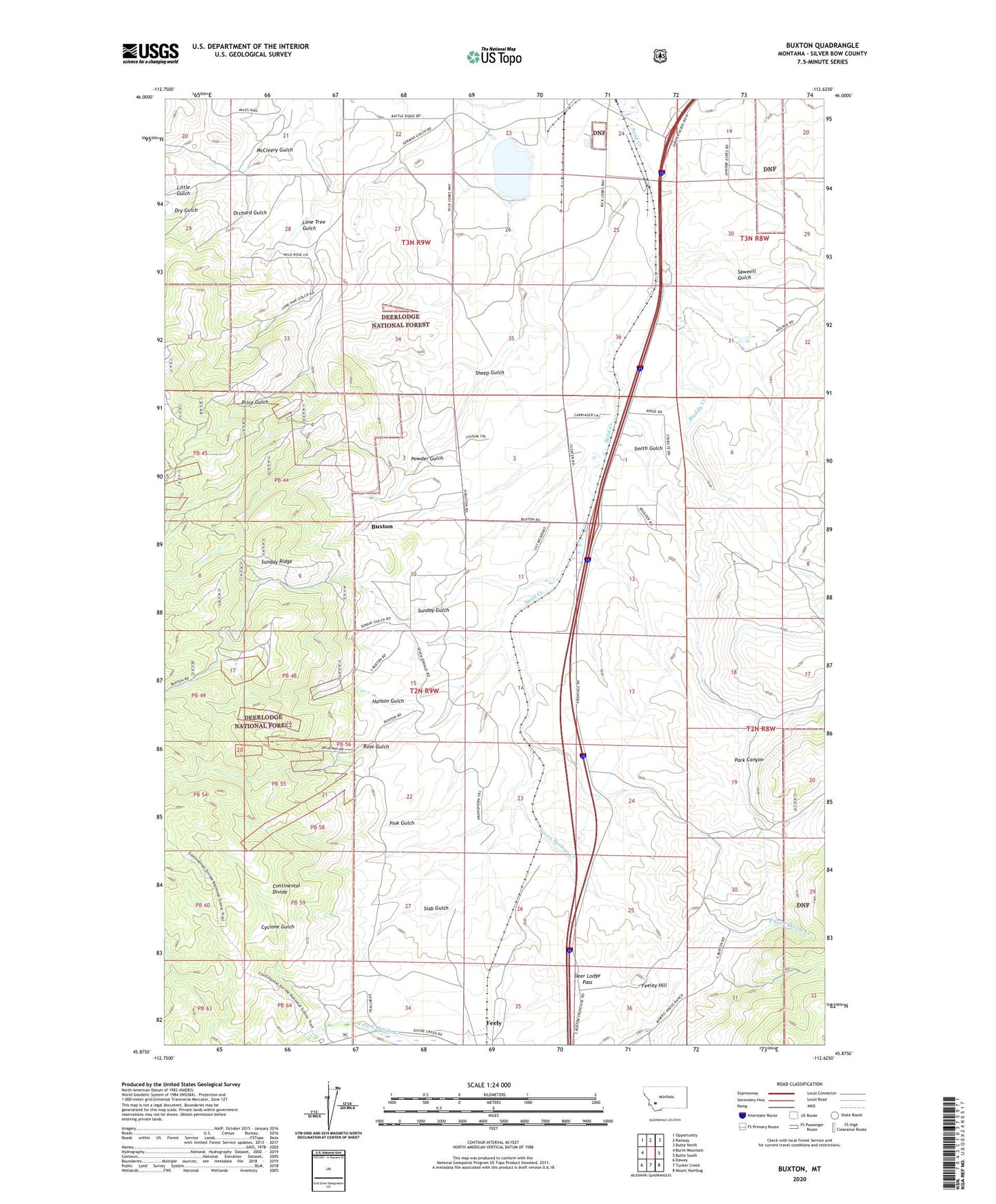
Buxton Montana US Topo Map
Couldn't load pickup availability
Also explore the Buxton Forest Service Topo of this same quad for updated USFS data
2024 topographic map quadrangle Buxton in the state of Montana. Scale: 1:24000. Based on the newly updated USGS 7.5' US Topo map series, this map is in the following counties: Silver Bow. The map contains contour data, water features, and other items you are used to seeing on USGS maps, but also has updated roads and other features. This is the next generation of topographic maps. Printed on high-quality waterproof paper with UV fade-resistant inks.
Quads adjacent to this one:
West: Burnt Mountain
Northwest: Opportunity
North: Ramsay
Northeast: Butte North
East: Butte South
Southeast: Mount Humbug
South: Tucker Creek
Southwest: Dewey
This map covers the same area as the classic USGS quad with code o45112h6.
Contains the following named places: Butte-Silver Bow, Butte-Silver Bow (balance), Buxton, Buxton Siding, Cyclone Gulch, Deer Lodge Pass, Dry Gulch, Enright, Feeley Hill, Feeley Post Office, Feely, Hanson Gulch, Little Gulch, Lone Tree Gulch, Muddy Creek, NW NE Section 32 Mine, Orchard Gulch, Park Canyon, Pink Gulch, Powder Gulch, Price Gulch, Rose Gulch, Sawmill Gulch, Seven Springs Creek, Sheep Gulch, Silver Bow County, Silver Bow Siding, Silverbow Post Office, Slab Gulch, Smith Gulch, Stauffer Chemical Number 1 Dam, Sunday Gulch, Sunday Ridge