MyTopo
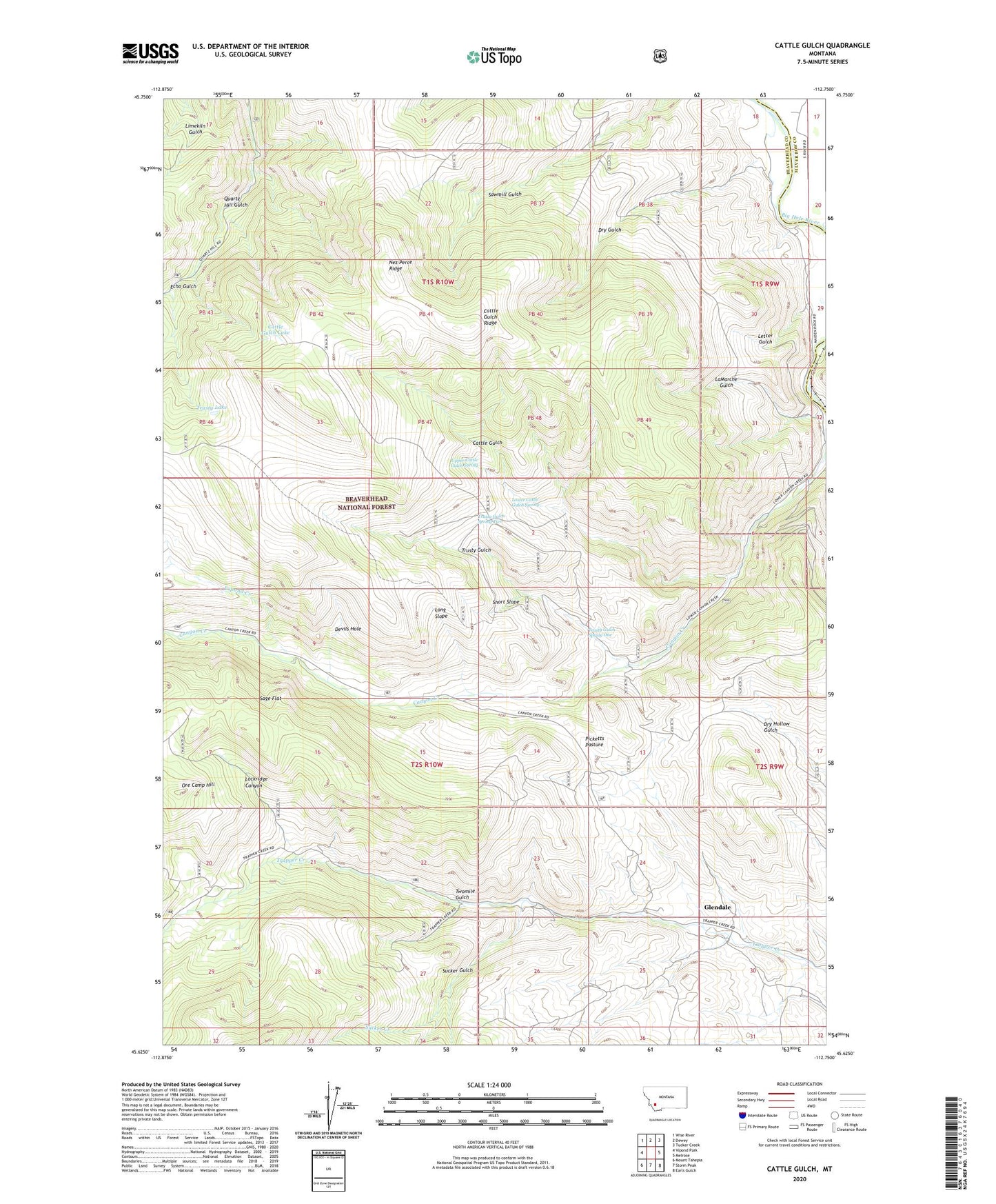
Cattle Gulch Montana US Topo Map
Couldn't load pickup availability
Also explore the Cattle Gulch Forest Service Topo of this same quad for updated USFS data
2024 topographic map quadrangle Cattle Gulch in the state of Montana. Scale: 1:24000. Based on the newly updated USGS 7.5' US Topo map series, this map is in the following counties: Beaverhead, Silver Bow. The map contains contour data, water features, and other items you are used to seeing on USGS maps, but also has updated roads and other features. This is the next generation of topographic maps. Printed on high-quality waterproof paper with UV fade-resistant inks.
Quads adjacent to this one:
West: Vipond Park
Northwest: Wise River
North: Dewey
Northeast: Tucker Creek
East: Melrose
Southeast: Earls Gulch
South: Storm Peak
Southwest: Mount Tahepia
This map covers the same area as the classic USGS quad with code o45112f7.
Contains the following named places: Canyon Creek Charcoal Kilns, Canyon Creek Point of Interest, Cattle Gulch, Cattle Gulch Lake, Cattle Gulch Ridge, Devils Hole, Divide Creek, Dry Gulch, Echo Gulch, Glendale, Glendale Post Office, Glendale School, Happy Camp, Happy Camp Park, Joyce Ranch, LaMarche Gulch, Letter Gulch, Lockridge Canyon, Long Slope, Lower Cattle Gulch Spring, Nez Perce Ridge, North Central Mine, NW NW Section 18 Mine, Ore Camp Hill, Picketts Pasture, Sage Flat, Short Shift Mine, Short Slope, Siria Ranch, Sucker Creek, Sucker Gulch, Trusty Gulch, Trusty Gulch Spring One, Trusty Gulch Spring Two, Trusty Lake, Twomile Gulch, Upper Cattle Gulch Spring, Vipond Creek, West Limb Mine