MyTopo
Tumble Mountain Montana US Topo Map
Couldn't load pickup availability
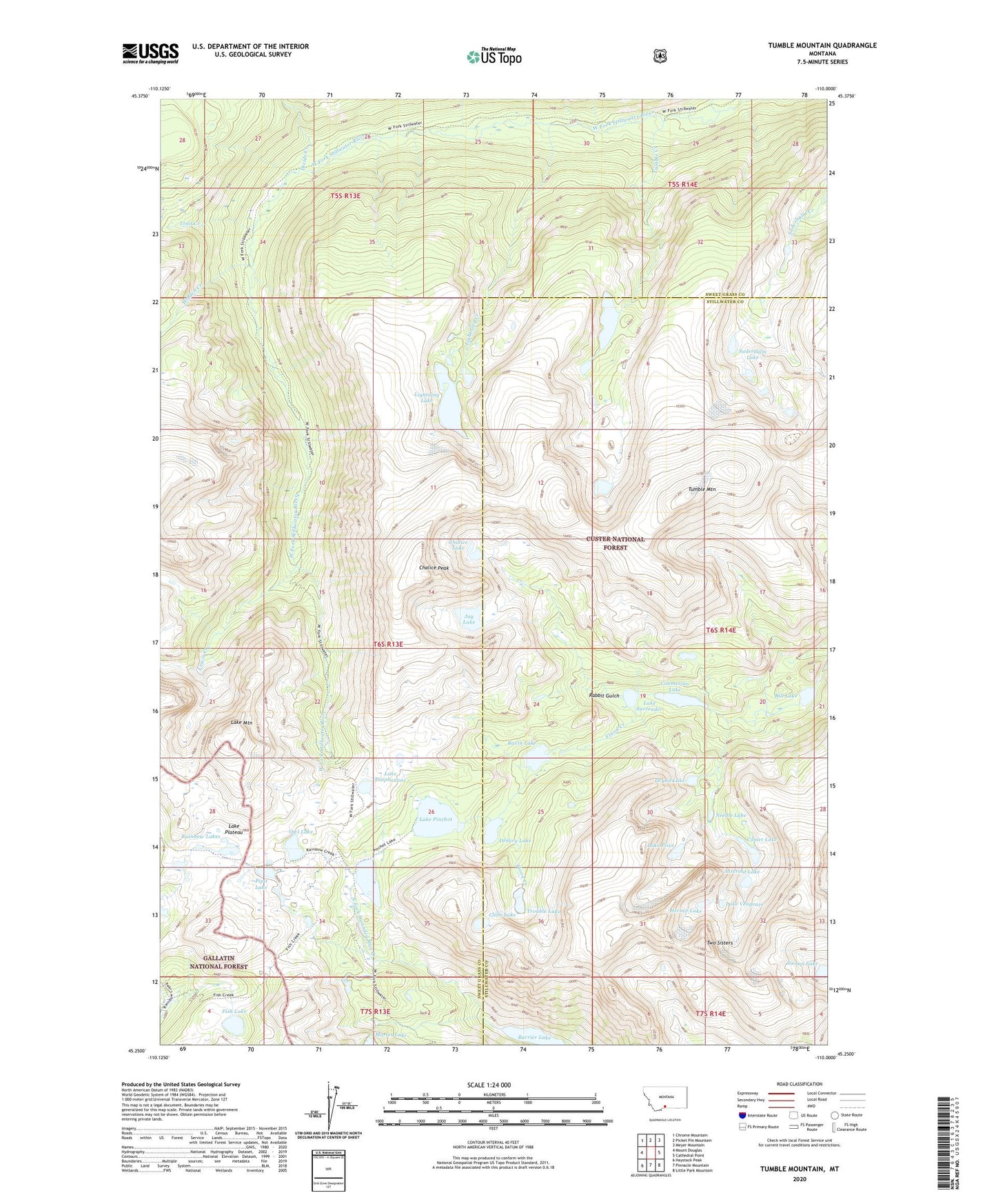
2020 topographic map quadrangle Tumble Mountain in the state of Montana. Scale: 1:24000. Based on the newly updated USGS 7.5' US Topo map series, this map is in the following counties: Sweet Grass, Stillwater. The map contains contour data, water features, and other items you are used to seeing on USGS maps, but also has updated roads and other features. This is the next generation of topographic maps. Printed on high-quality waterproof paper with UV fade-resistant inks.
Quads adjacent to this one:
West: Mount Douglas
Northwest: Chrome Mountain
North: Picket Pin Mountain
Northeast: Meyer Mountain
East: Cathedral Point
Southeast: Little Park Mountain
South: Pinnacle Mountain
Southwest: Haystack Peak
Contains the following named places: Asteroid Lake, Barrier Lake, Bill Lake, Chalice Lake, Chalice Peak, Cimmerian Lake, Clam Lake, Comet Lake, Crescent Creek, Divide Creek, Dreary Lake, Dryad Lake, Fish Lake, Hermit Lake, Hidden Creek, Jasper Lake, Jay Lake, Lake Diaphanous, Lake Mountain, Lake Pinchot, Lake Pisce, Lake Plateau, Lake Surrender, Lake Vengence, Lewis Creek, Lightning Creek, Lightning Lake, Needle Lake, Owl Lake, Pipit Lake, Rabbit Gulch, Ravin Lake, Saderbalm Lake, Trail Creek, Trouble Lake, Tumble Creek, Tumble Mountain, Two Sisters, Wounded Man Lake