MyTopo
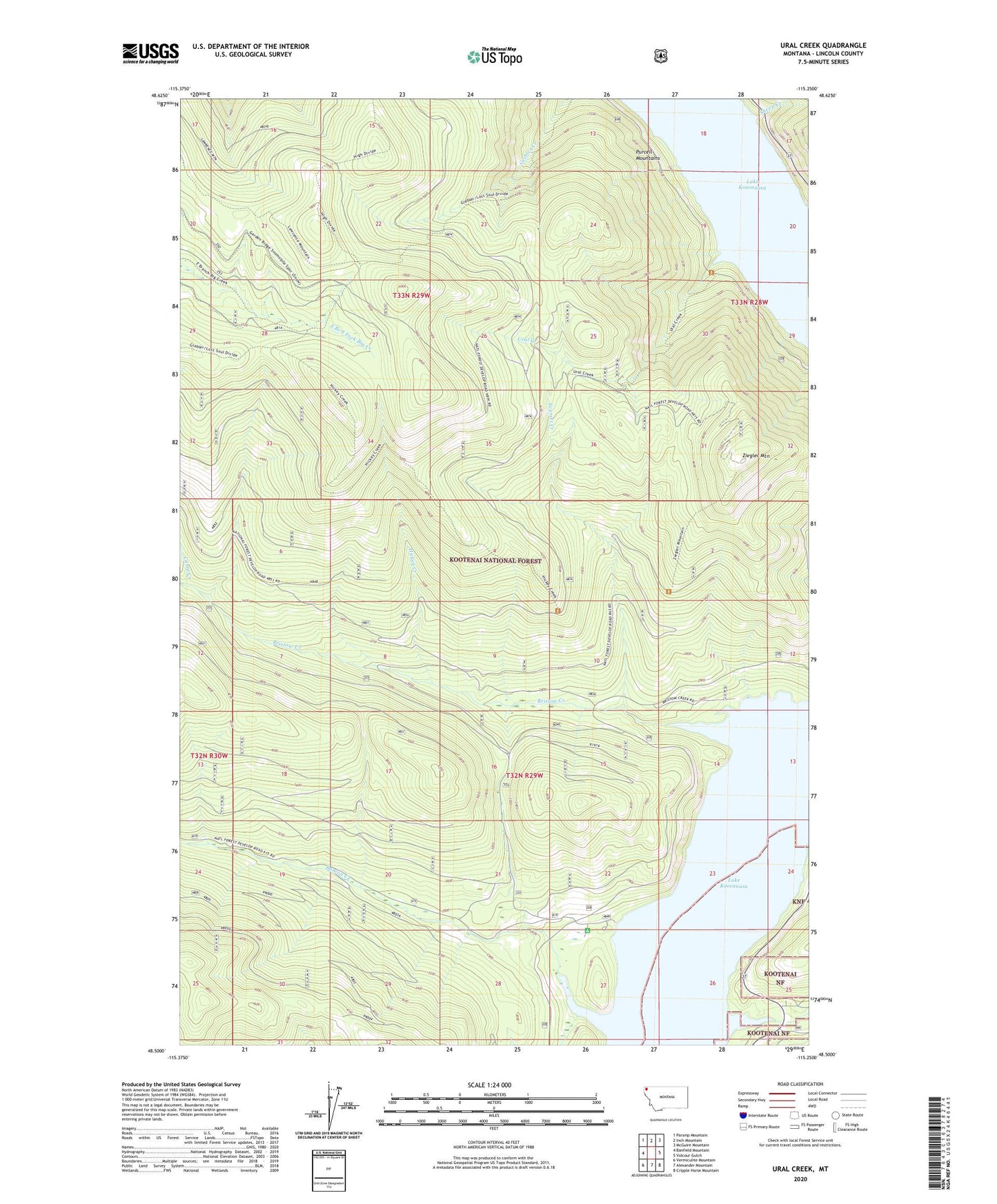
Ural Creek Montana US Topo Map
Couldn't load pickup availability
Also explore the Ural Creek Forest Service Topo of this same quad for updated USFS data
2024 topographic map quadrangle Ural Creek in the state of Montana. Scale: 1:24000. Based on the newly updated USGS 7.5' US Topo map series, this map is in the following counties: Lincoln. The map contains contour data, water features, and other items you are used to seeing on USGS maps, but also has updated roads and other features. This is the next generation of topographic maps. Printed on high-quality waterproof paper with UV fade-resistant inks.
Quads adjacent to this one:
West: Banfield Mountain
Northwest: Parsnip Mountain
North: Inch Mountain
Northeast: McGuire Mountain
East: Volcour Gulch
Southeast: Cripple Horse Mountain
South: Alexander Mountain
Southwest: Vermiculite Mountain
This map covers the same area as the classic USGS quad with code o48115e3.
Contains the following named places: Barren Creek Boat Ramp, Barron Creek, Bristow Creek, Camp Creek, Everett Creek, Hickey Creek, Sheep Creek, Ural, Ural Creek, Ural Post Office, Warland, Warland Post Office, Warland School, Ziegler Mountain