MyTopo
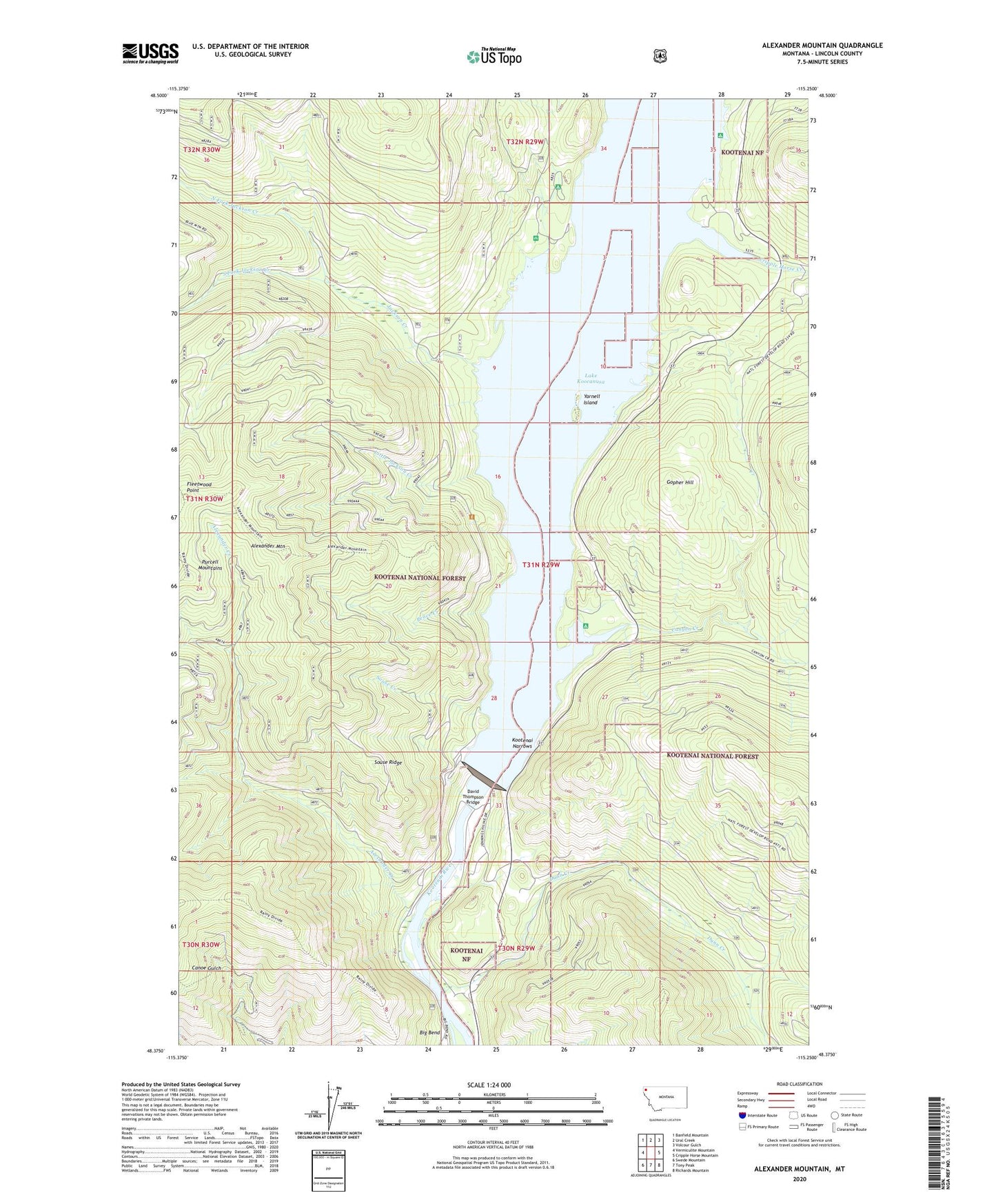
Alexander Mountain Montana US Topo Map
Couldn't load pickup availability
Also explore the Alexander Mountain Forest Service Topo of this same quad for updated USFS data
2024 topographic map quadrangle Alexander Mountain in the state of Montana. Scale: 1:24000. Based on the newly updated USGS 7.5' US Topo map series, this map is in the following counties: Lincoln. The map contains contour data, water features, and other items you are used to seeing on USGS maps, but also has updated roads and other features. This is the next generation of topographic maps. Printed on high-quality waterproof paper with UV fade-resistant inks.
Quads adjacent to this one:
West: Vermiculite Mountain
Northwest: Banfield Mountain
North: Ural Creek
Northeast: Volcour Gulch
East: Cripple Horse Mountain
Southeast: Richards Mountain
South: Tony Peak
Southwest: Swede Mountain
This map covers the same area as the classic USGS quad with code o48115d3.
Contains the following named places: Alexander Creek, Alexander Mountain, Canyon Creek, Cripple Horse Creek, Cripple Horse Marina, David Thompson Bridge, Dunn Creek, Dunn Creek Flats, Fleetwood Point, Gopher Hill, Hook-U-Up RV Park, Jackson Creek, Koocanusa Resort, Kootenai Narrows, Libby Dam, Libby Dam Visitor Center, Little Jackson Creek, McGillivray Campground, North Fork Jackson Creek, Peace Creek, Souse Creek, Souse Gulch Picnic Area, Souse Ridge, South Fork Jackson Creek, Warland Creek, Yarnell, Yarnell Island, Yarnell Island Campground