MyTopo
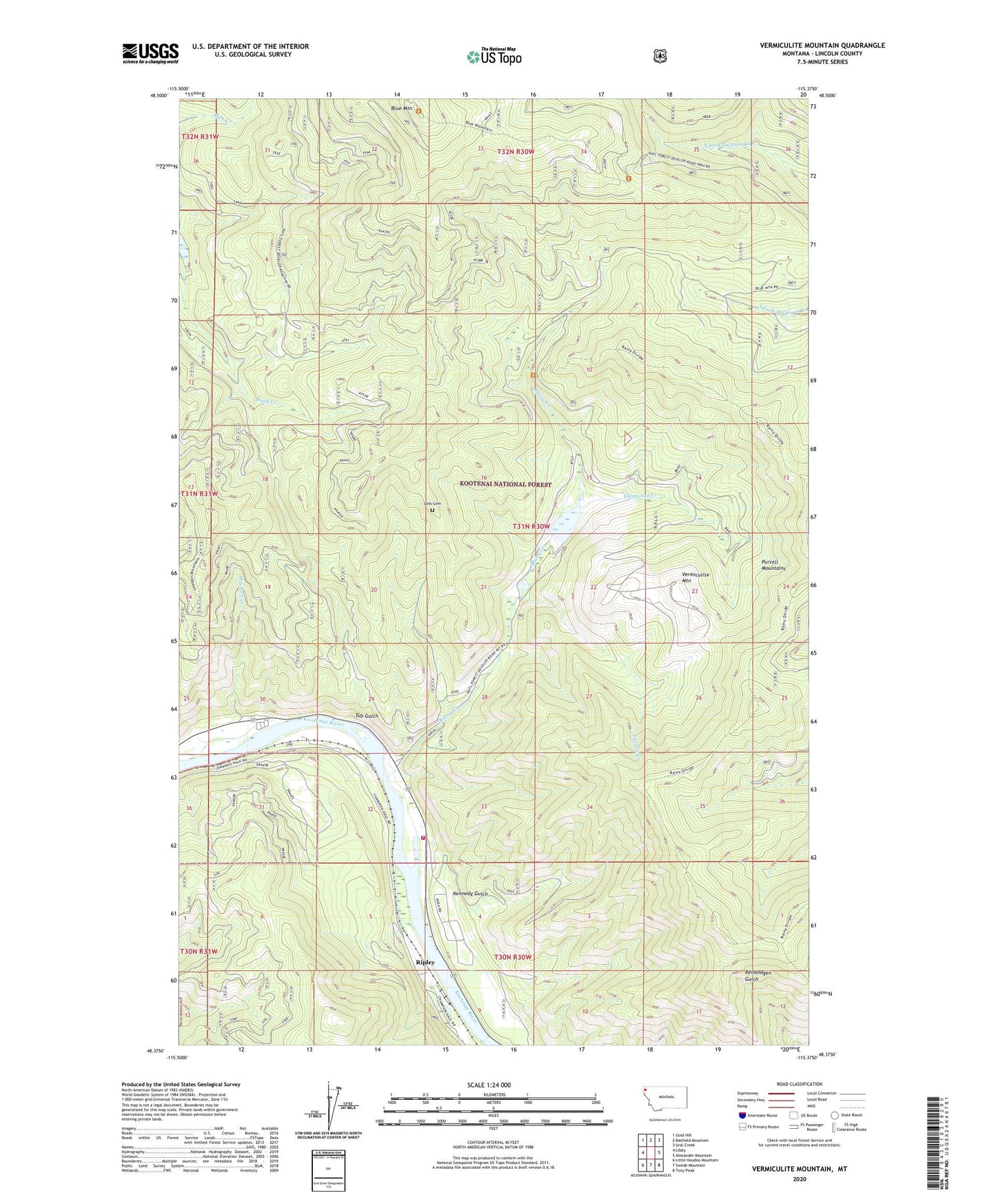
Vermiculite Mountain Montana US Topo Map
Couldn't load pickup availability
Also explore the Vermiculite Mountain Forest Service Topo of this same quad for updated USFS data
2024 topographic map quadrangle Vermiculite Mountain in the state of Montana. Scale: 1:24000. Based on the newly updated USGS 7.5' US Topo map series, this map is in the following counties: Lincoln. The map contains contour data, water features, and other items you are used to seeing on USGS maps, but also has updated roads and other features. This is the next generation of topographic maps. Printed on high-quality waterproof paper with UV fade-resistant inks.
Quads adjacent to this one:
West: Libby
Northwest: Gold Hill
North: Banfield Mountain
Northeast: Ural Creek
East: Alexander Mountain
Southeast: Tony Peak
South: Swede Mountain
Southwest: Little Hoodoo Mountain
This map covers the same area as the classic USGS quad with code o48115d4.
Contains the following named places: 30N31W10DBB01_ Well, Bakker Ranch, Blue Mountain, Blue Mountain Lookout Station, Carney Creek, Fleetwood Creek, Kennedy Gulch, Kootenai Post, Leib Cemetery, Lincoln County Rural Fire District Station 2, Mitchell Creek, Mitchell Creek Mine, Rainy Creek, Ripley, Tub Gulch, Vermiculite Mountain, Zonolite Tailings Dam