MyTopo
Volborg Montana US Topo Map
Couldn't load pickup availability
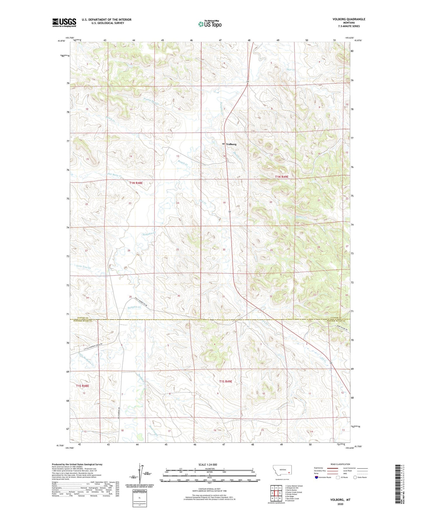
2024 topographic map quadrangle Volborg in the state of Montana. Scale: 1:24000. Based on the newly updated USGS 7.5' US Topo map series, this map is in the following counties: Custer, Powder River. The map contains contour data, water features, and other items you are used to seeing on USGS maps, but also has updated roads and other features. This is the next generation of topographic maps. Printed on high-quality waterproof paper with UV fade-resistant inks.
Quads adjacent to this one:
West: Foster Creek School
Northwest: Carey-Malone School
North: Kirkpatrick Hill
Northeast: Harris Buttes
East: Divide School
Southeast: Coalwood
South: Box Elder Creek
Southwest: Elk Ridge
This map covers the same area as the classic USGS quad with code o45105g6.
Contains the following named places: 01N48E22ACBB01 Well, 01N49E18BDAA01 Well, 01N49E30DBBC01 Well, 01S48E13ACAB01 Well, 01S48E20DCAC01 Well, 01S49E09CBAD01 Well, 01S49E14ADCD01 Well, 01S49E18ADAC01 Well, Allen Number 6 Dam, Deer Creek, Flat Butte Creek, Little Pumpkin Creek, Lone Tree Creek, Prairie Dog Creek, Ranch Creek, S L Creek, Sand Coulee, Shelter Creek, Volborg, Volborg Post Office