MyTopo
Box Elder Creek Montana US Topo Map
Couldn't load pickup availability
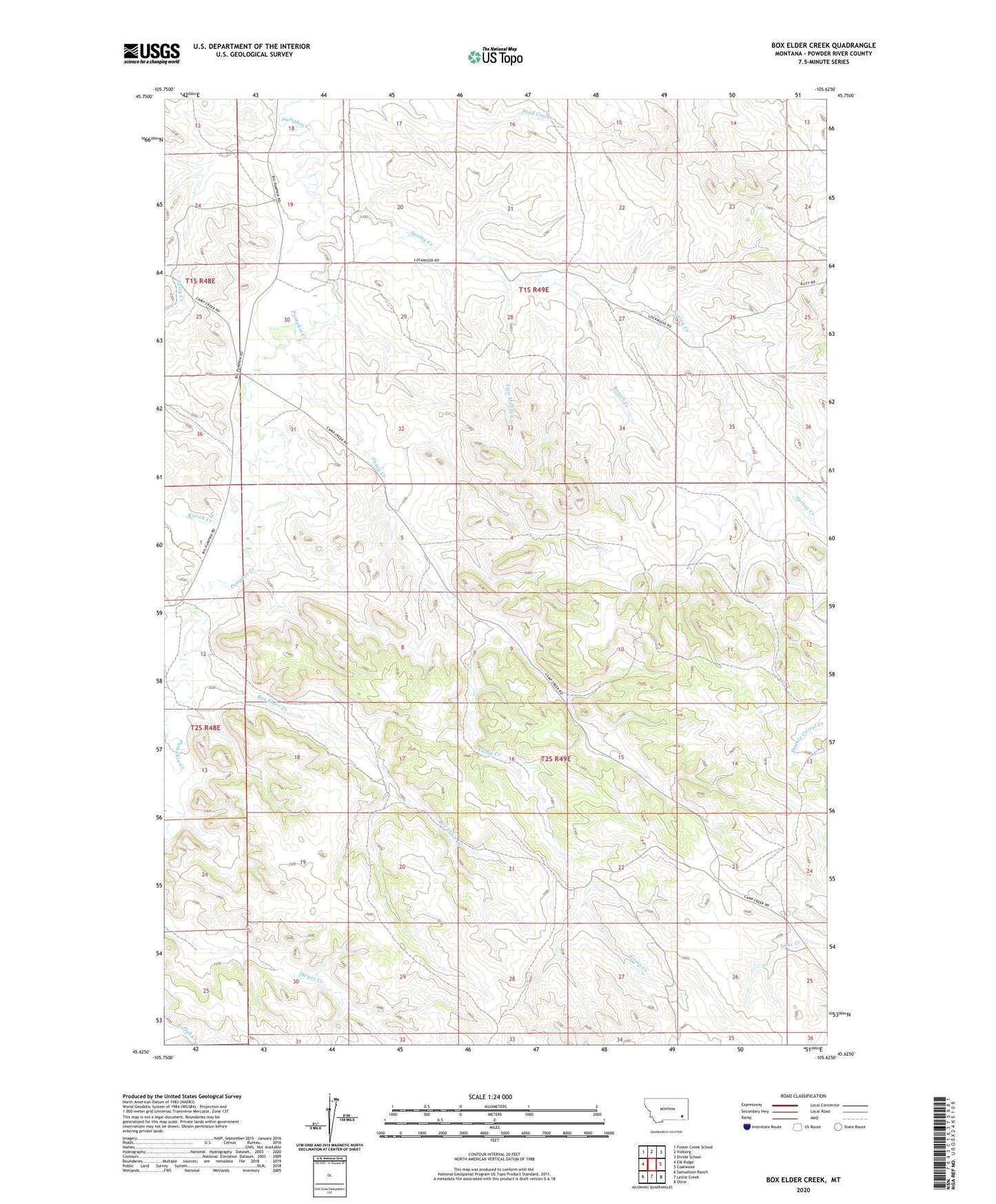
2024 topographic map quadrangle Box Elder Creek in the state of Montana. Scale: 1:24000. Based on the newly updated USGS 7.5' US Topo map series, this map is in the following counties: Powder River. The map contains contour data, water features, and other items you are used to seeing on USGS maps, but also has updated roads and other features. This is the next generation of topographic maps. Printed on high-quality waterproof paper with UV fade-resistant inks.
Quads adjacent to this one:
West: Elk Ridge
Northwest: Foster Creek School
North: Volborg
Northeast: Divide School
East: Coalwood
Southeast: Olive
South: Leslie Creek
Southwest: Samuelson Ranch
This map covers the same area as the classic USGS quad with code o45105f6.
Contains the following named places: 01S48E24CACD01 Well, 01S49E16DDBC01 Well, 01S49E23CACD01 Well, 01S49E29DADA01 Well, 01S49E30ABBA01 Well, 01S49E31BDCC01 Well, 02S49E18BABB01 Well, 02S49E19CADA01 Well, 02S49E22CBAA01 Well, 02S49E22DCCA01 Well, 02S49E22DCCA02 Well, 02S49E22DCCA03 Well, 02S49E22DCCA04 Well, 02S49E22DCCA05 Well, 02S49E26AACA01 Well, 02S49E26AADA01 Well, 02S51E11ADBB01 Well, Box Elder Creek, Camp Creek, Kiwah Creek, Rough Creek, Salty Creek, Spring Creek, Tilton Spring Creek, Two Moons Creek