MyTopo
Weingart Place NW Montana US Topo Map
Couldn't load pickup availability
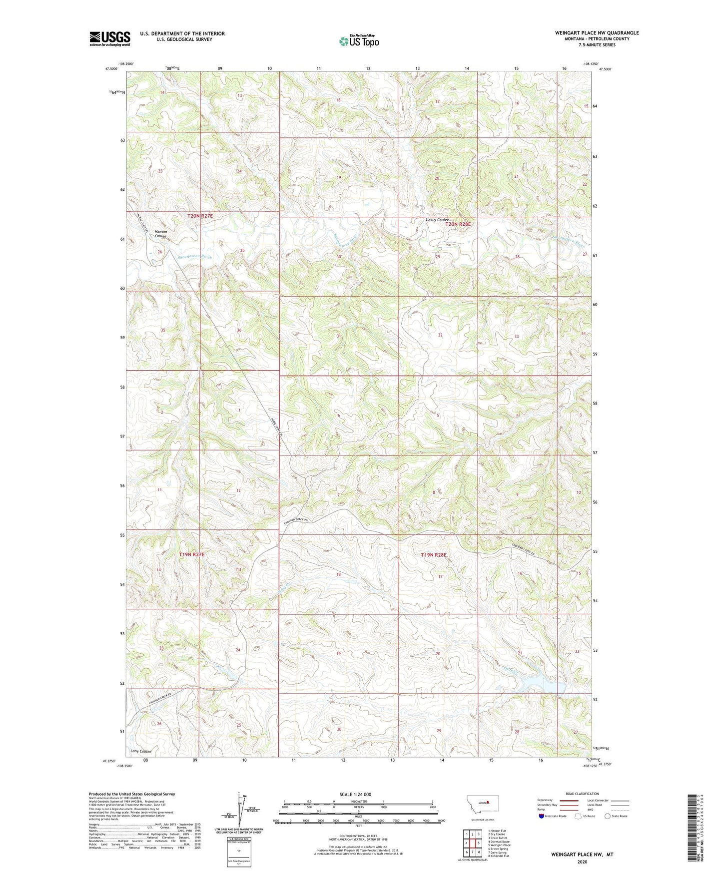
2024 topographic map quadrangle Weingart Place NW in the state of Montana. Scale: 1:24000. Based on the newly updated USGS 7.5' US Topo map series, this map is in the following counties: Petroleum. The map contains contour data, water features, and other items you are used to seeing on USGS maps, but also has updated roads and other features. This is the next generation of topographic maps. Printed on high-quality waterproof paper with UV fade-resistant inks.
Quads adjacent to this one:
West: Dovetail Butte
Northwest: Hanson Flat
North: Dry Coulee
Northeast: Chain Buttes
East: Weingart Place
Southeast: Kirkendal Flat
South: Davis Spring
Southwest: Brown Spring
This map covers the same area as the classic USGS quad with code o47108d2.
Contains the following named places: 19N27E24DCAD01 Well, 20N28E29BA__01 Well, Clamhopper Number 1 Dam, Drag Dam, Hanson Coulee, Spring Coulee