MyTopo
Westby South Montana US Topo Map
Couldn't load pickup availability
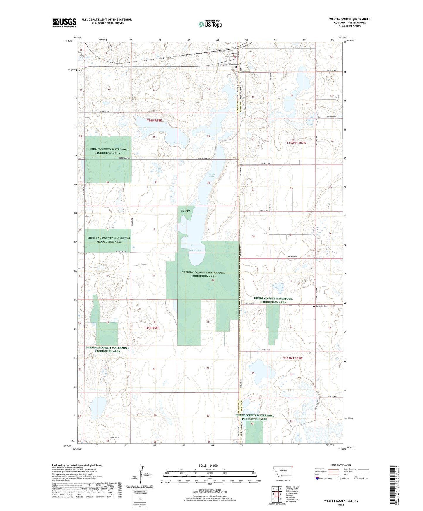
2024 topographic map quadrangle Westby South in the states of Montana, North Dakota. Scale: 1:24000. Based on the newly updated USGS 7.5' US Topo map series, this map is in the following counties: Sheridan, Divide. The map contains contour data, water features, and other items you are used to seeing on USGS maps, but also has updated roads and other features. This is the next generation of topographic maps. Printed on high-quality waterproof paper with UV fade-resistant inks.
Quads adjacent to this one:
West: Tadpole Lake
Northwest: Lone Tree Lake
North: Westby North
Northeast: Skjermo Lake
East: Alkabo
Southeast: Camp Lake
South: Dominek Lake
Southwest: Coalridge
Contains the following named places: 35N58E01AADA01 Well, 35N58E01ACDA01 Well, 35N58E01ADC_01 Well, 35N58E01ADDA01 Well, 35N58E01DABB01 Well, 35N58E01DBAA01 Well, 35N58E01DBDD01 Well, 35N58E24AAAA01 Well, 35N58E24DDDD01 Well, 36N58E23BACA01 Well, Assembly of God Church, Daneville Cemetery, Farmers Elevator Company of Fortuna, First Lutheran Church of Westby, Goose Lake, Immanuel Lutheran Church, Noelle Meyer Memorial Park, Onstad Park, Saint Elizabeth Catholic Church, Sheridan County Waterfowl Production Area, Spring Valley School, Town of Westby, Westby, Westby Cemetery, Westby Post Office, Westby Schools, Westby Volunteer Fire Department, Woodrow School