MyTopo
Tadpole Lake Montana US Topo Map
Couldn't load pickup availability
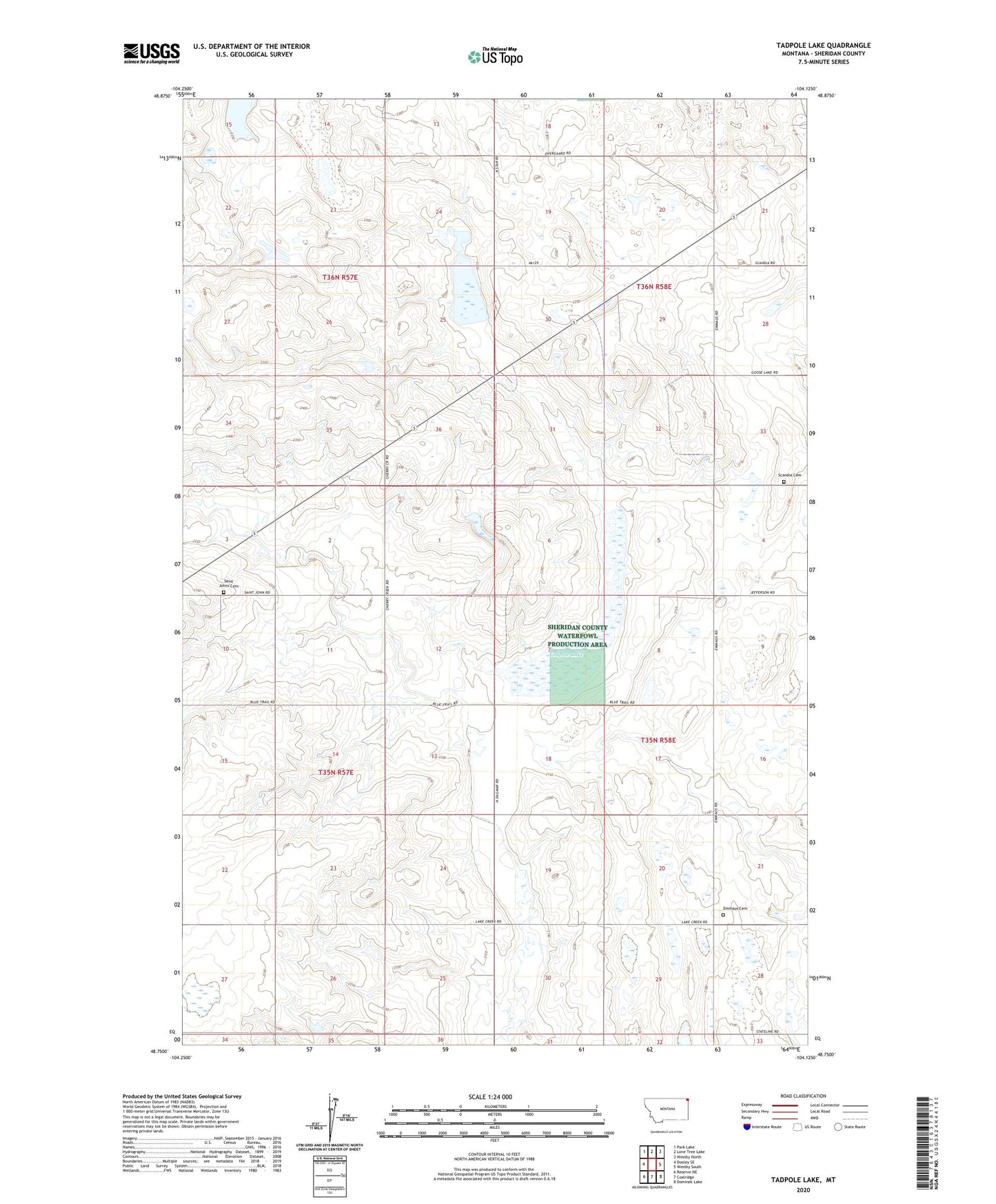
2024 topographic map quadrangle Tadpole Lake in the state of Montana. Scale: 1:24000. Based on the newly updated USGS 7.5' US Topo map series, this map is in the following counties: Sheridan. The map contains contour data, water features, and other items you are used to seeing on USGS maps, but also has updated roads and other features. This is the next generation of topographic maps. Printed on high-quality waterproof paper with UV fade-resistant inks.
Quads adjacent to this one:
West: Dooley SE
Northwest: Park Lake
North: Lone Tree Lake
Northeast: Westby North
East: Westby South
Southeast: Dominek Lake
South: Coalridge
Southwest: Reserve NE
This map covers the same area as the classic USGS quad with code o48104g2.
Contains the following named places: 35N57E02DACC01 Well, 36N57E25DACC01 Well, 36N58E29CBCA01 Well, 59275, Coolidge School, Emmaus Cemetery, Emmaus Lutheran Church, Jefferson School, McKinley School, Reed Number 2 Dam, Roosevelt School, Saint John Congregation, Saint Johns Cemetery, Scandia Cemetery, Scandia Lutheran Free Church, Tadpole Lake, Washington School, Westby Division