MyTopo
Lone Tree Lake Montana US Topo Map
Couldn't load pickup availability
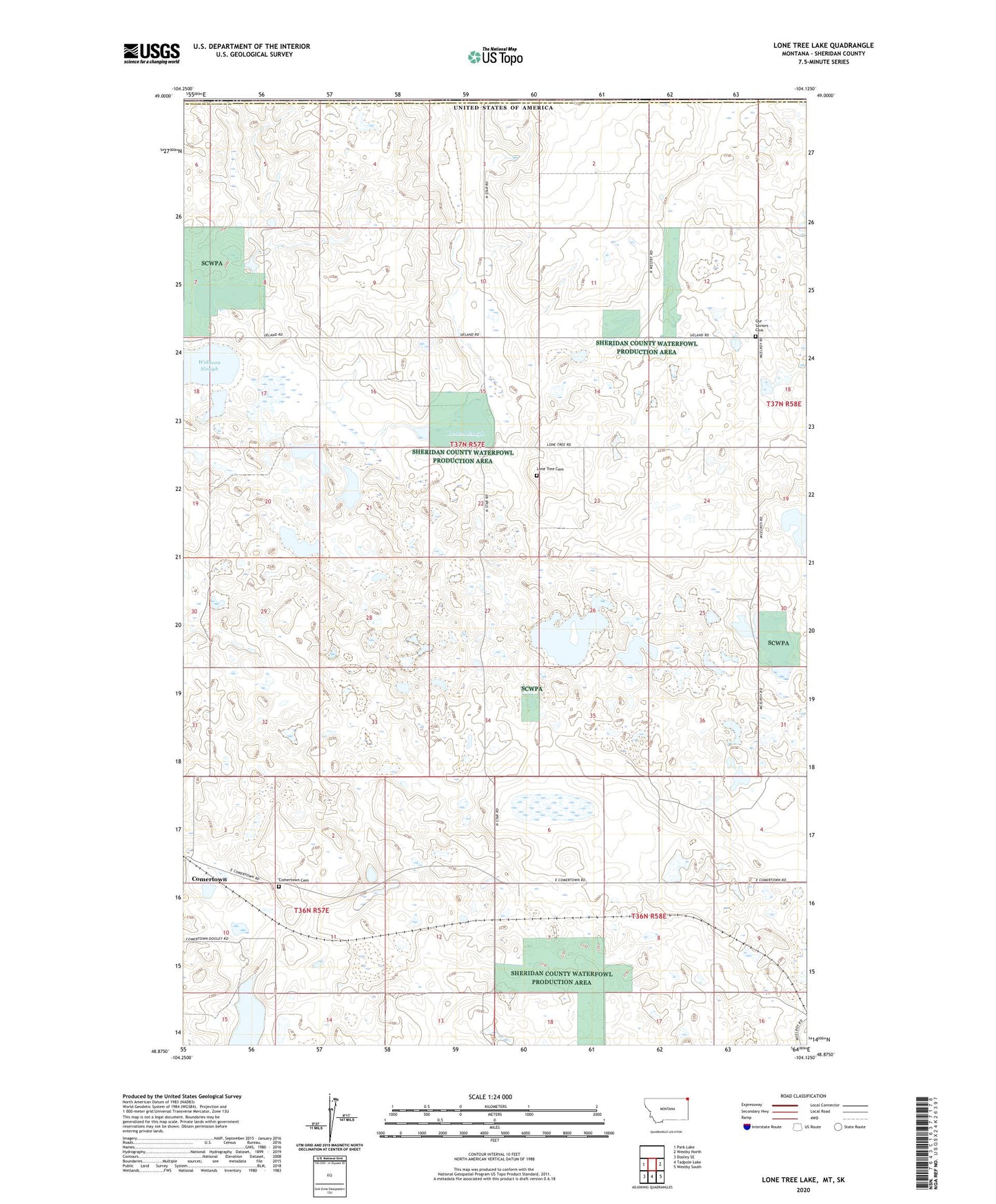
2024 topographic map quadrangle Lone Tree Lake in the state of Montana. Scale: 1:24000. Based on the newly updated USGS 7.5' US Topo map series, this map is in the following counties: Sheridan. The map contains contour data, water features, and other items you are used to seeing on USGS maps, but also has updated roads and other features. This is the next generation of topographic maps. Printed on high-quality waterproof paper with UV fade-resistant inks.
Quads adjacent to this one:
West: Park Lake
East: Westby North
Southeast: Westby South
South: Tadpole Lake
Southwest: Dooley SE
This map covers the same area as the classic USGS quad with code o48104h2.
Contains the following named places: 36N57E07BDBA01 Well, 37N57E08BAAA01 Well, 37N58E18CBCC01 Well, Comertown, Comertown Cemetery, Comertown Post Office, Lakeside School, Larson Slough, Lone Tree Cemetery, Lone Tree Lake, Lone Tree Lutheran Church, Our Saviors Cemetery, Our Saviors Lutheran Church, Pleasant Valley Lutheran, Reed Number 1 Dam, Ueland School, Widgeon Slough