MyTopo
White Horse Coulee Montana US Topo Map
Couldn't load pickup availability
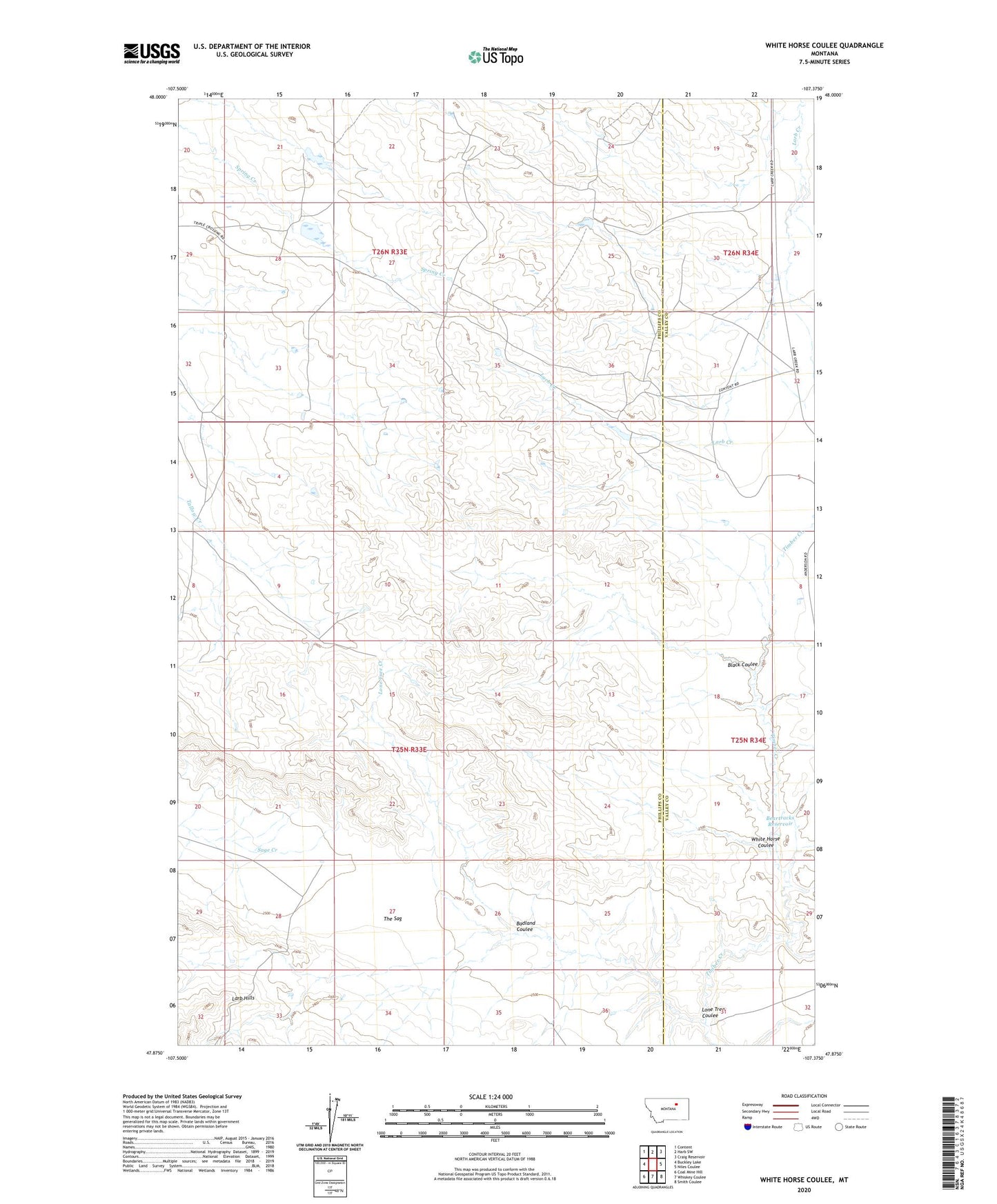
2020 topographic map quadrangle White Horse Coulee in the state of Montana. Scale: 1:24000. Based on the newly updated USGS 7.5' US Topo map series, this map is in the following counties: Phillips, Valley. The map contains contour data, water features, and other items you are used to seeing on USGS maps, but also has updated roads and other features. This is the next generation of topographic maps. Printed on high-quality waterproof paper with UV fade-resistant inks.
Quads adjacent to this one:
West: Buckley Lake
Northwest: Content
North: Harb SW
Northeast: Craig Reservoir
East: Niles Coulee
Southeast: Smith Coulee
South: Whiskey Coulee
Southwest: Coal Mine Hill
Contains the following named places: Badland Coulee, Beartracks Reservoir, Black Coulee, Lone Tree Coulee, Lone Tree Creek, The Sag, White Horse Coulee