MyTopo
Snedaker Basin Montana US Topo Map
Couldn't load pickup availability
Also explore the Snedaker Basin Forest Service Topo of this same quad for updated USFS data
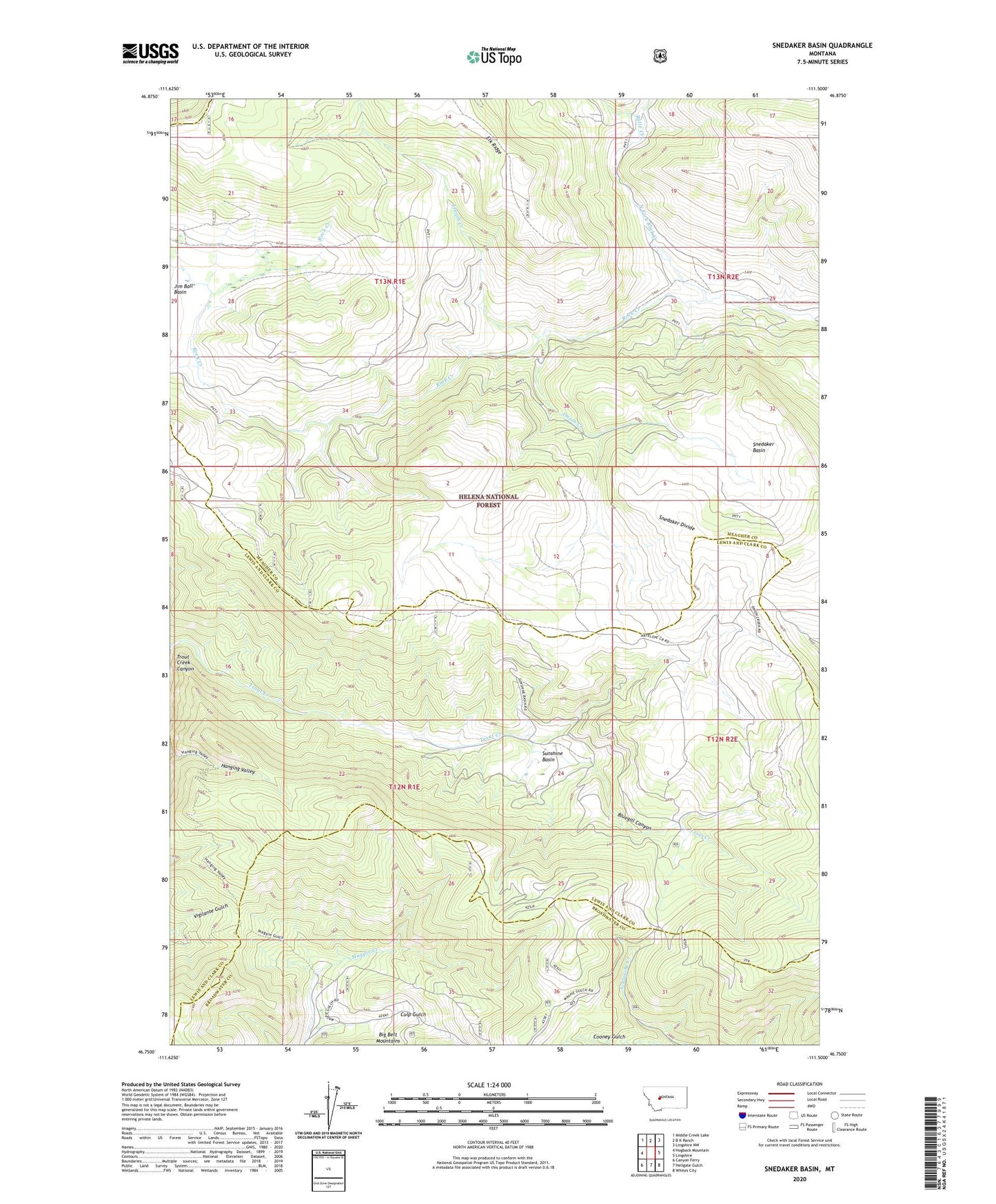
2024 topographic map quadrangle Snedaker Basin in the state of Montana. Scale: 1:24000. Based on the newly updated USGS 7.5' US Topo map series, this map is in the following counties: Meagher, Lewis and Clark, Broadwater. The map contains contour data, water features, and other items you are used to seeing on USGS maps, but also has updated roads and other features. This is the next generation of topographic maps. Printed on high-quality waterproof paper with UV fade-resistant inks.
Quads adjacent to this one:
West: Hogback Mountain
Northwest: Middle Creek Lake
North: B K Ranch
Northeast: Lingshire NW
East: Lingshire
Southeast: Whites City
South: Hellgate Gulch
Southwest: Canyon Ferry
This map covers the same area as the classic USGS quad with code o46111g5.
Contains the following named places: Bluegill Canyon, Butte Creek, Culp Gulch, French Creek, Hanging Valley National Recreation Trail, Indian Creek, Jim Ball Basin, North Fork Rock Creek, Onion Creek, Snedaker Basin, Snedaker Divide, Sunshine Basin, Sunshine Ranch, Vigilante National Recreation Trail, Vista