MyTopo
Whitetail Reservoir Montana US Topo Map
Couldn't load pickup availability
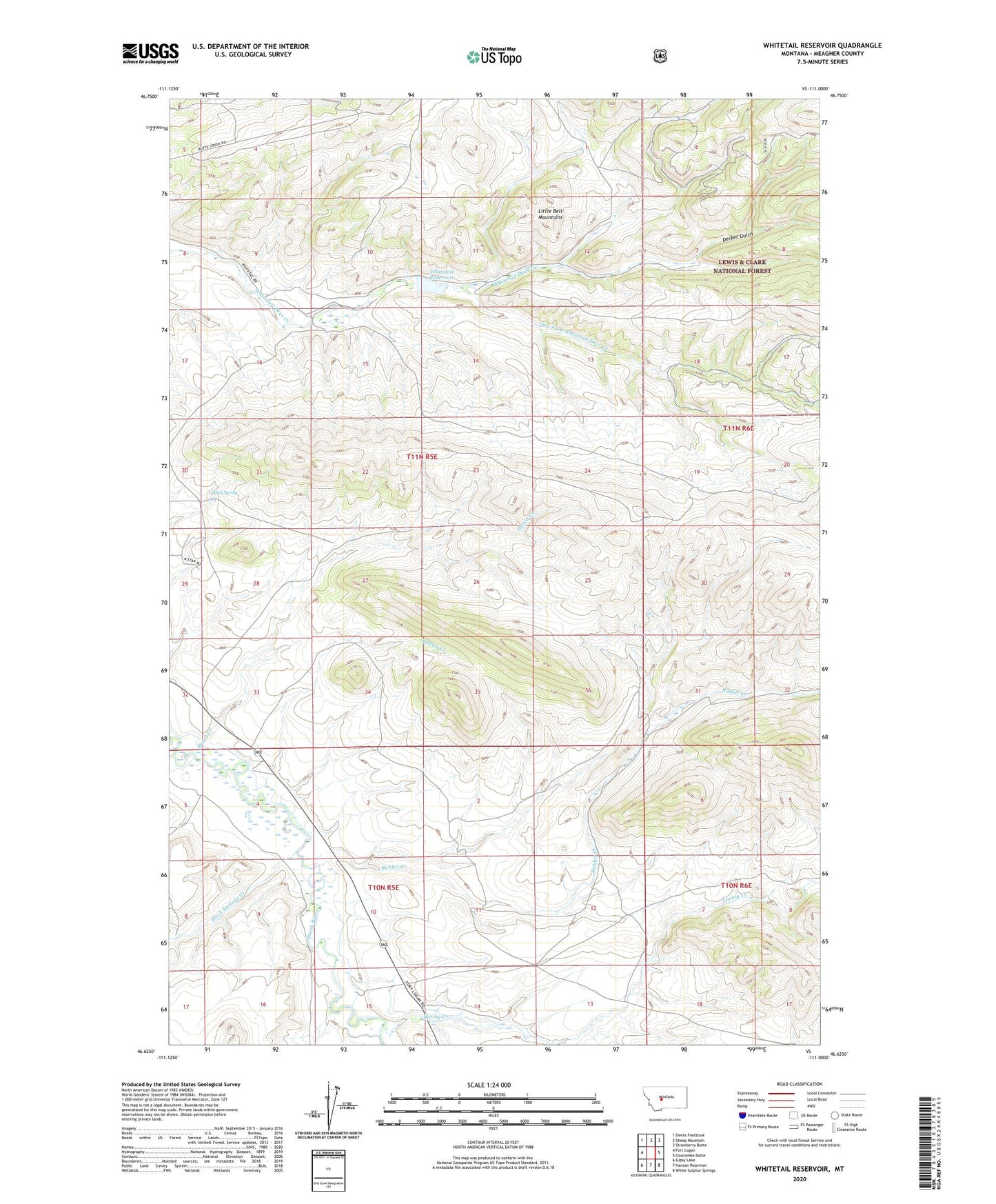
2020 topographic map quadrangle Whitetail Reservoir in the state of Montana. Scale: 1:24000. Based on the newly updated USGS 7.5' US Topo map series, this map is in the following counties: Meagher. The map contains contour data, water features, and other items you are used to seeing on USGS maps, but also has updated roads and other features. This is the next generation of topographic maps. Printed on high-quality waterproof paper with UV fade-resistant inks.
Quads adjacent to this one:
West: Fort Logan
Northwest: Devils Footstool
North: Sheep Mountain
Northeast: Strawberry Butte
East: Coxcombe Butte
Southeast: White Sulphur Springs
South: Hanson Reservoir
Southwest: Gipsy Lake
Contains the following named places: 10N05E02C___01 Well, 10N05E04BA__01 Well, 10N05E05AD__01 Well, 59645, Decker Gulch, Dry Fork Whitetail Deer Creek, Hatch Creek, Mud Spring, Rabbit Creek, Rock Springs Creek, Spring Creek, White Sulphur Springs Division, Whitetail Dam, Whitetail Reservoir