MyTopo
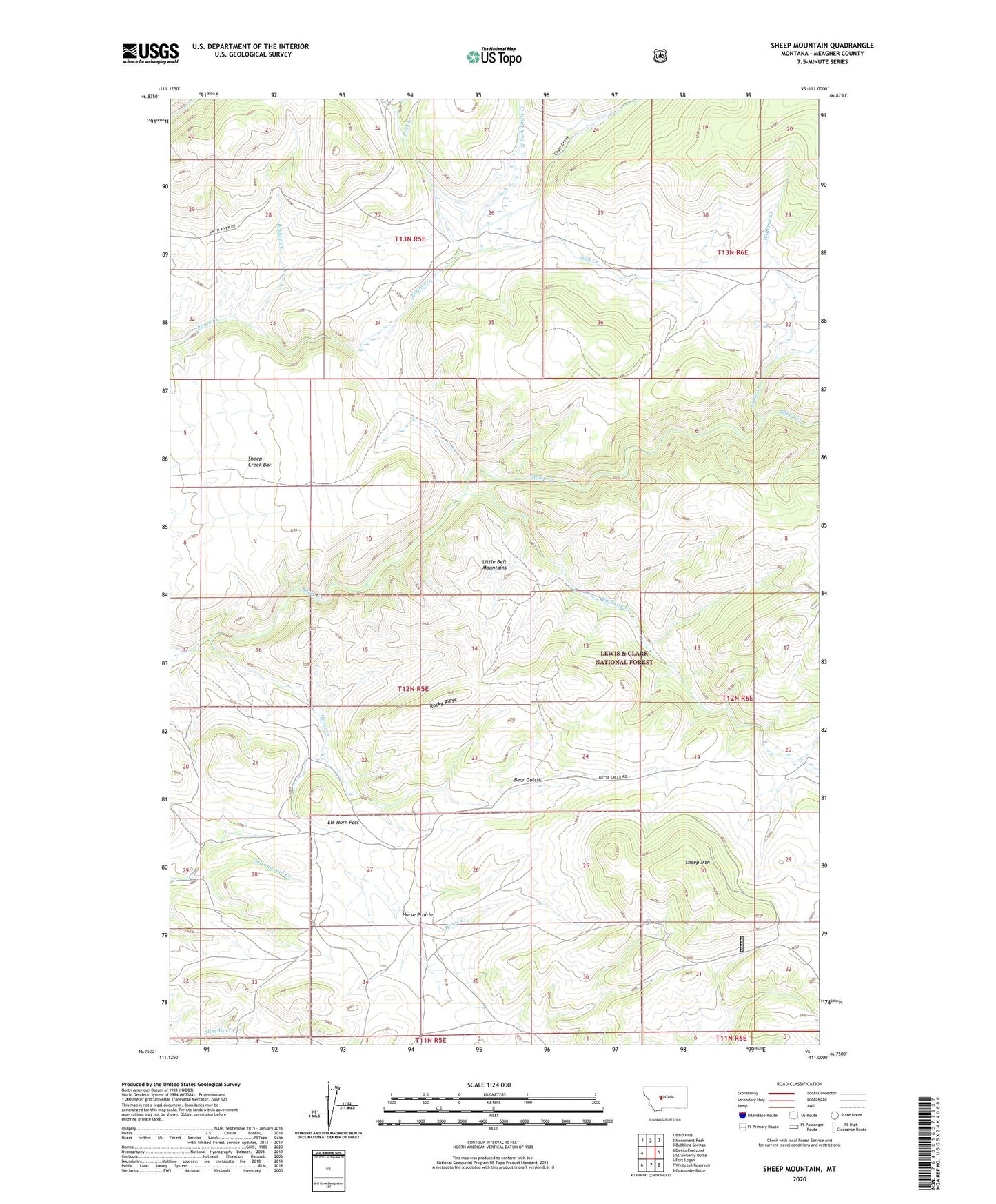
Sheep Mountain Montana US Topo Map
Couldn't load pickup availability
Also explore the Sheep Mountain Forest Service Topo of this same quad for updated USFS data
2024 topographic map quadrangle Sheep Mountain in the state of Montana. Scale: 1:24000. Based on the newly updated USGS 7.5' US Topo map series, this map is in the following counties: Meagher. The map contains contour data, water features, and other items you are used to seeing on USGS maps, but also has updated roads and other features. This is the next generation of topographic maps. Printed on high-quality waterproof paper with UV fade-resistant inks.
Quads adjacent to this one:
West: Devils Footstool
Northwest: Bald Hills
North: Monument Peak
Northeast: Bubbling Springs
East: Strawberry Butte
Southeast: Coxcombe Butte
South: Whitetail Reservoir
Southwest: Fort Logan
This map covers the same area as the classic USGS quad with code o46111g1.
Contains the following named places: Bear Gulch, Big Butte Creek, Bridge Creek, Cabin Creek, Elk Horn Pass, Horse Creek, Horse Prairie, Jack Creek, Mc Guire Ranch, North Fork Eagle Creek, Park Creek, Pole Creek, Rocky Ridge, Shannon Post Office, Shannon School, Sheep Creek Bar, Sheep Mountain, Williams Creek